Hilary And Irwin Interaction Shown
Tropical cyclone development in the eastern Pacific Ocean has been occurring at a slightly above normal pace this year. Hurricanes Hilary and Irwin were the two most recently named tropical cyclones to form in this area. These two were a little unusual because they traveled so close to each other that an interaction occurred that radically changed the direction and speed of tropical storm Irwin's movement. The Fujiwara effect happens when cyclones move close of one another. Their centers will sometimes begin orbiting cyclonically (in the northern hemisphere) about a point between the two systems. The larger tropical cyclone (Hilary) often dominates the interaction. The smaller tropical cyclone, tropical storm Irwin in this case, orbits around the larger tropical cyclone. Sometime the two tropical cyclones merge into one storm. Irwin did slow and moved to the northeast. The merging of the two didn't happen this time because Hilary moved over colder waters and lost energy before the two could combine.
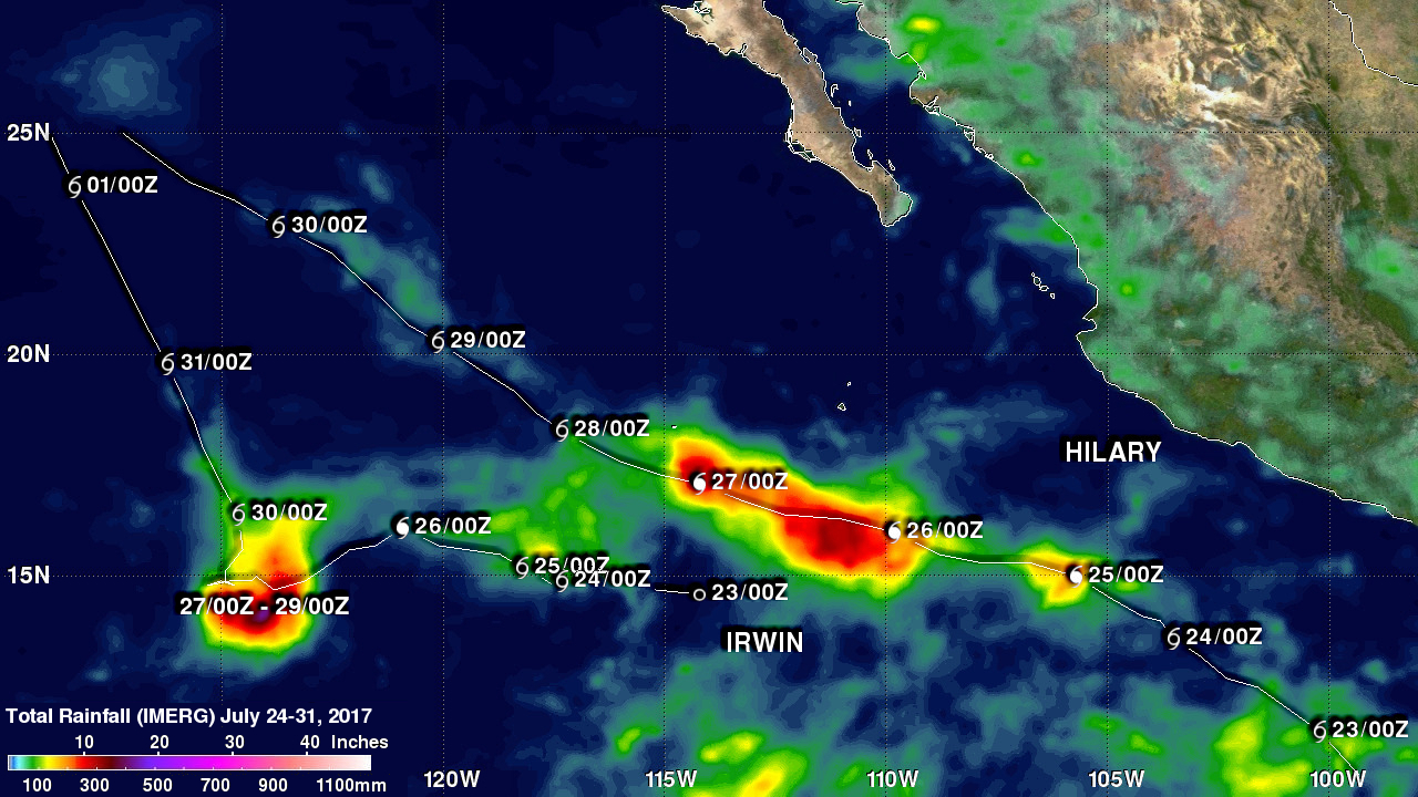
The tracks of Hilary and Irwin are shown overlaid on this analysis of accumulated rainfall. It was made using data produced from July 24-31, 2017 by NASA's Integrated Multi-satellitE Retrievals (IMERG). Dates and approximate locations of the two hurricane's 0000Z daily positions are shown overlaid in white. The radical change to Irwin's track by Hilary's circulation is obvious. Hilary's course was expected to become more westerly as it rotated in that direction but that change in course isn't apparent. A maximum of total rainfall to over 500 mm (19.7 inches) occurred where Irwin was forced to slow and become nearly stationary for a while.
Hilary dissipated over cooler waters on July 30, 2017. Irwin also dissipated for the same reason on August 1, 2017 as it tagged along behind Hilary.