
Hurricane Blanca Seen Traveling to Baja
After moving very little for the last few days hurricane Blanca has again started to move toward the Baja Peninsula. The GPM core observatory satellite passed directly over Blanca on June 4, 2015 at 2056 UTC when the hurricane had maximum sustained wind speeds of about 85 kts (~98 mph).
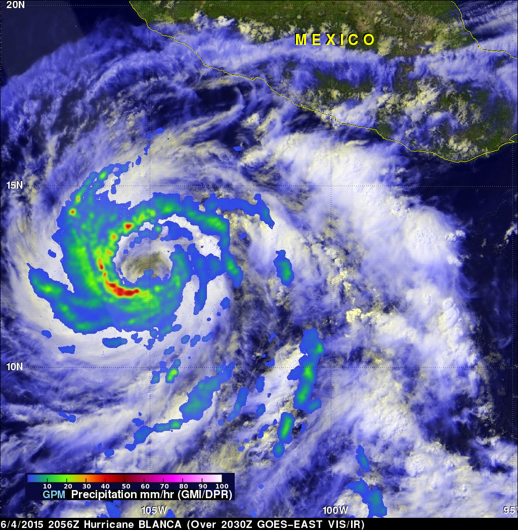
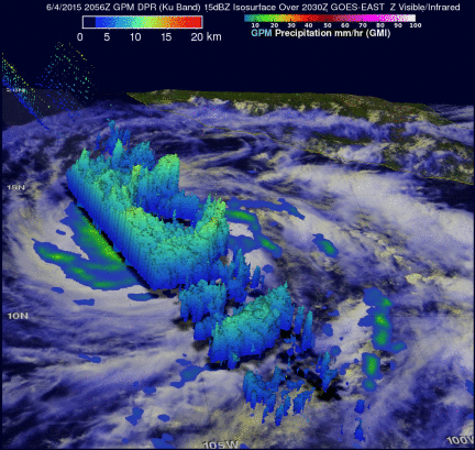
GPM discovered that Blanca had very little convective rainfall in the center of a large cloudy eye. The satellite's Microwave Imager (GMI) and Dual-Frequency Precipitation Radar (Ku Band) instruments measured rain falling at a rate of over 85mm (3.3 inches) per hour in a band of powerful storms moving around the southwestern side of the hurricane. An animation shows where towering convective thunderstorms and rain (green) falling at a rate of over 10 mm (.4 inches) per hour were located. Some storm top heights reaching altitudes above 13 km (8.1 miles) were measured by GPM's Ku band radar.
Hurricane Blanca is predicted to weaken to tropical storm intensity before it hits the Baja Peninsula early next week. The remnants of Blanca may then bring rainfall to the southwestern United States in the middle of next week.