Hurricane Guillermo Heads Toward Hawaii
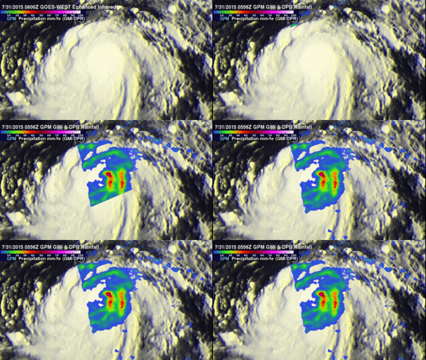
On July 29, 2015 tropical depression Nine-E formed in the eastern Pacific Ocean well southwest of the southern tip of Baja California. The tropical depression was in an area of warm ocean water which helped the tropical cyclone blossom into tropical storm Guillermo early on July 30, 2015. Guillermo is a hurricane today and is headed over the open waters of the Pacific Ocean toward the west-northwest. In about a week Guillermo may affect the Hawaiian Islands as a tropical storm. On July 31, 2015 at 0556 UTC Guillermo was about 319 km (~590 Nautical Miles) east-southeast of Hilo, Hawaii when the GPM core observatory satellite passed above. This animation shows the location of rainfall derived from the GPM satellite's Microwave Imager (GMI) overlaid on an infrared image captured by the GOES-WEST satellite at close to the same time. Those data revealed that rain was falling at a rate of over 88 mm (~3.5 inches) per hour in some storms northeast of the intensifying hurricane's center.
The National Hurricane Center (NHC) predicts that hurricane Guillermo's winds will peak at about 100kts (115 mph) on Saturday July 1, 2015 and then gradually weaken back to tropical storm intensity of 50 kts (~ 58 mph) while approaching the island of Hawaii on Wednesday August 5, 2015.


