
Hurricane Hilda Weakening, Heads Toward Hawaii
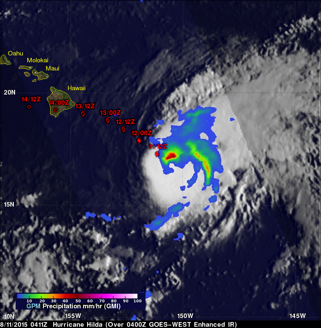
Three days ago Hilda was a category four hurricane on the Saffir-Simpson Hurricane Wind Scale with winds of 120 kts (138 mph). Hilda has been weakening and had winds of about 80 kts (92 mph) when the GPM core observatory satellite passed above on August 11, 2015 at 0411 UTC (August 10, 2015 at 6:11 PM HST). Rainfall data from GPM's Microwave Imager (GMI) instrument is shown overlaid on a 0400 UTC August 11, 2015 GOES-WEST Infrared image. GPM's GMI revealed that storms north of hurricane Hilda's eye were dropping rain at a rate of over 53.6 mm (2.2 inches) per hour.
Hilda's future positions, based on a recent Central Pacific Hurricane Center forecast, are shown in red. Hilda is predicted to weaken to a tropical storm with winds of about 35 kts (40.3 mph) before hitting the Hawaiian Islands in a couple days.