
Ida Weakened by Strong Shear in the Atlantic
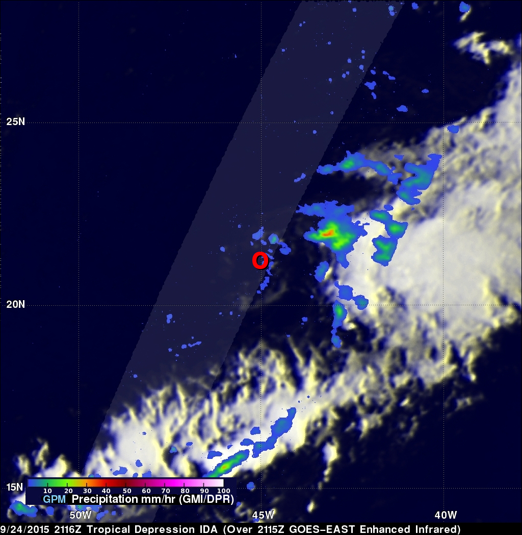
Tropical Depression Ida has struggled to maintain itself in the Central Atlantic well east of the Leeward Islands where it has been ravaged by strong wind shear. Since forming back on the 18th of September, Ida has not been able to strengthen beyond a moderate tropical storm, reaching a peak intensity of 45 knots (50 mph) early on the morning of the 21st before succumbing to the effects of strong northwesterly winds from an upper-level trough. Since that time, Ida has struggled maintain itself between a depression and a weak tropical storm, while being mired in the Central Atlantic. This most recent overpass from GPM was taken at 21:16 UTC (5:16 pm EDT) on 24 September 2015. It shows that the center of Ida's circulation (shown by the red tropical depression symbol) is almost completely devoid of clouds and precipitation with just a small curved band of weak showers just east of the center providing evidence for its existence. Slightly more substantial areas of rain are located well east of the low-level center as a result of strong westerly winds aloft, which are shearing the storm apart.
In a typical season, there are about 10 named storms and 6 hurricanes. So far this year, several storms have formed in the Atlantic, some such as Danny and Fred have even become hurricanes, but none have been able to traverse the Atlantic and approach the US as a result of strong wind shear. This same fate appears to be in store for Ida, which is forecast to further weaken to a remnant area of low pressure within the next 1 to 2 days by the National Hurricane Center.
GPM is a joint mission between NASA and the Japanese space agency JAXA.