
IMERG Sees Gulf Rainfall With Tropical Storm Bill
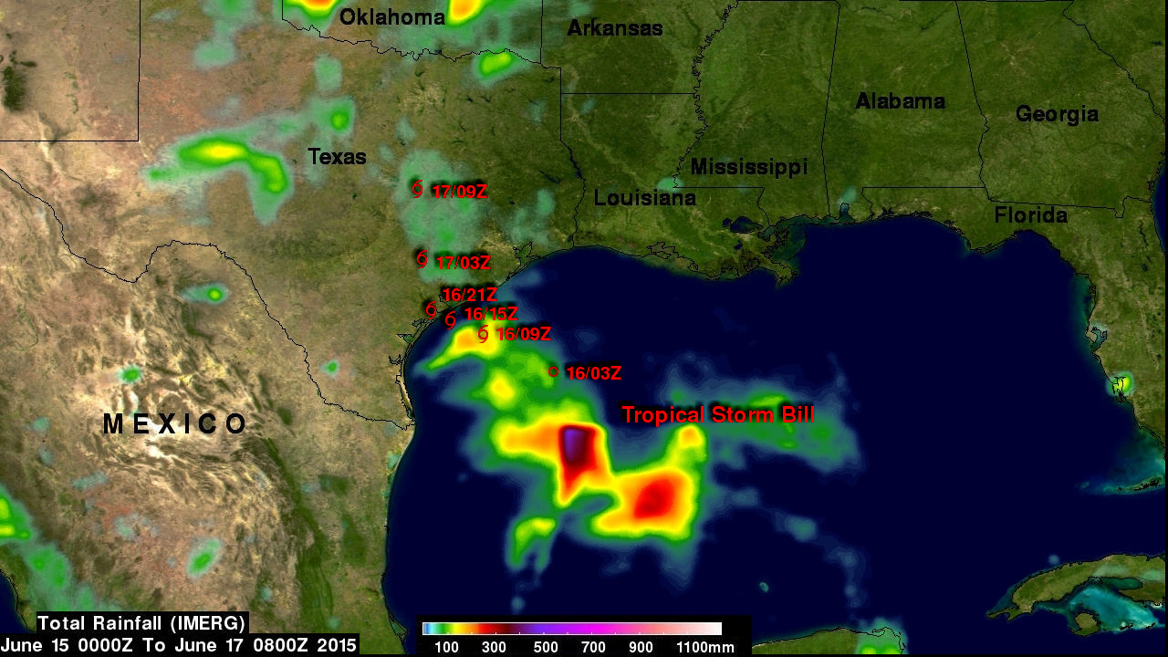
Tropical storm Bill became the second named tropical cyclone in the Atlantic Ocean Basin when it formed in the western Gulf Of Mexico on June 16, 2015. Data from the NASA's Integrated Multi-satellitE Retrievals for GPM (IMERG) was used in this analysis to estimate rainfall from Tropical Storm Bill. Precipitation was analyzed from the time when tropical storm Bill was forming in the Gulf Of Mexico on Monday June 15, 2015 until early this morning at 0800 UTC (4 AM CDT). The storm was dropping heavy rainfall over Texas this morning but this analysis indicates that the heaviest rainfall totals, up to this time, of over 500mm (19.7 inches) were located in the Gulf Of Mexico east of Texas. Rainfall totals over land will add up as Bill moves through Oklahoma and other states over the next few days with flash floods possible in areas already recovering from earlier flooding.
Click here to see a Quicktime animation 1280x720 of tropical storm Bill's rainfall.
Click here to see an MPEG animation 1280x720 of tropical storm Bill's rainfall.