
Increased Western Pacific Tropical Cyclone Activity Seen By GPM
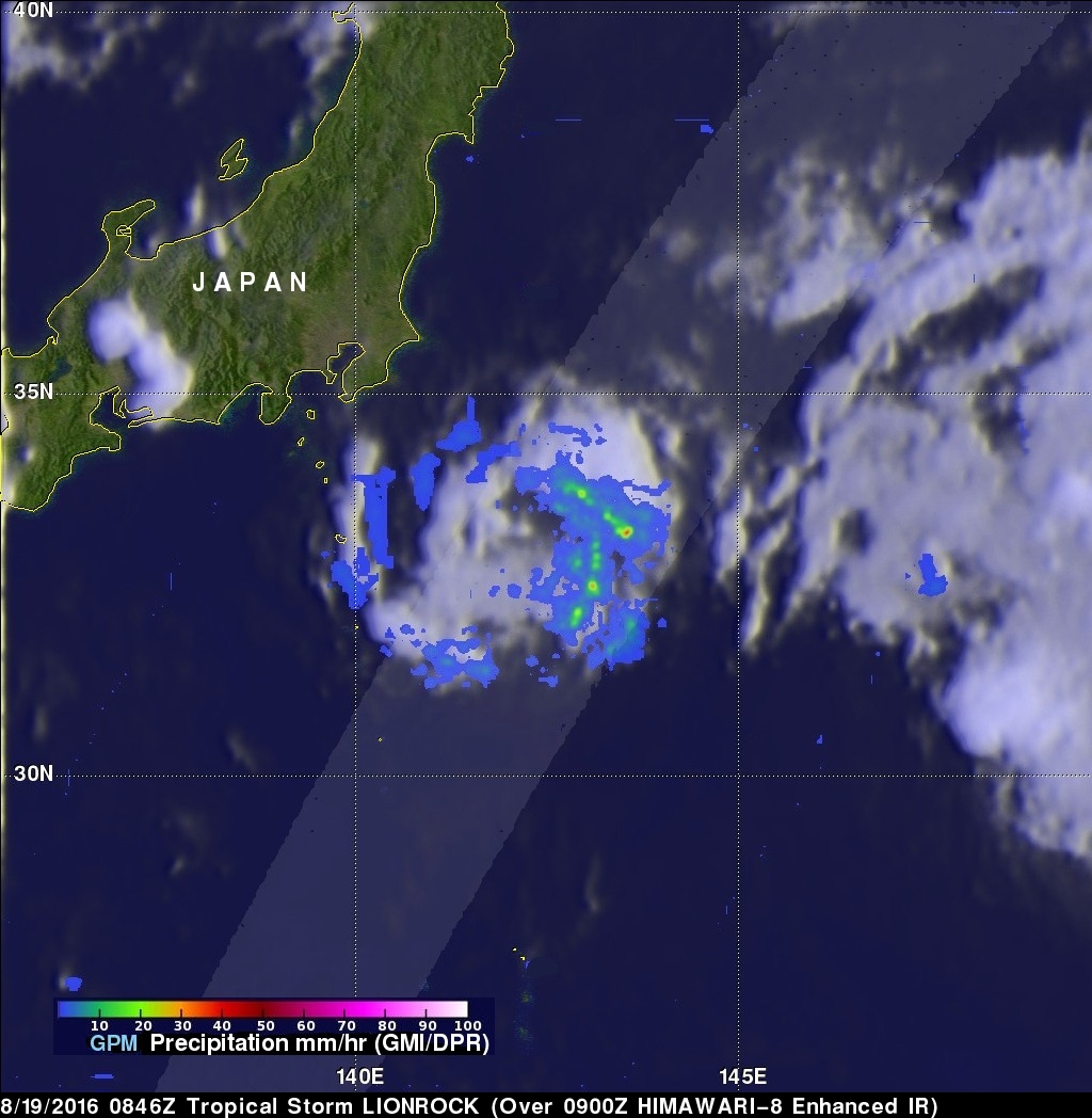
The first typhoon in the western Pacific Ocean (NEPARTAK) didn't form until July this year. Since then tropical cyclone activity has increased with four of the named tropical cyclones coming near Japan. Typhoon Chantu recently brought strong winds and heavy rain to northern Japan. Tropical storm Lionrock quickly followed Chantu and is predicted to strengthen little while moving past to the south of Japan. Another tropical storm called Mindulle formed today in the Pacific Ocean northwest of Guam. Mindulle is predicted to move northward, intensify and become a typhoon just before hitting southern Japan in about three days.
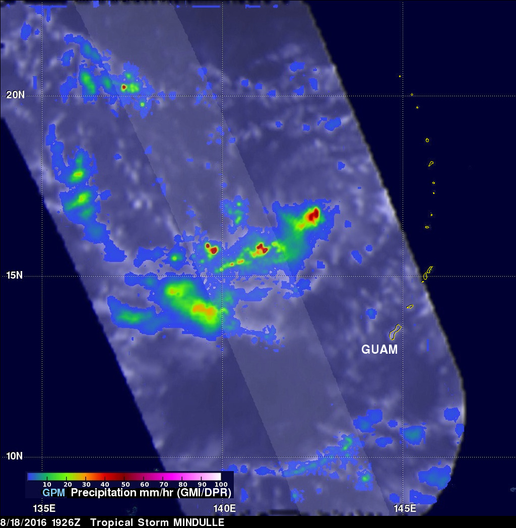
Tropical storm Lionrock and forming tropical storm Mindulle were both recently seen by the GPM core observatory satellite. These GPM views show a large contrast between the storms. Lionrock, shown southeast of Japan, was a very small tropical cyclone with a few bands of moderate to heavy rain bands wrapping around the southeastern side of the storm. A view of forming tropical storm Mindulle's rainfall was derived from GPM's Microwave Imager (GMI) and Dual-Frequency Precipitation Radar (DPR) data. Those data show a much larger area of rainfall near forming tropical storm Mindulle with some showers measured by DPR coming down at a rate of about 120 mm (4.7 inches) per hour or greater.
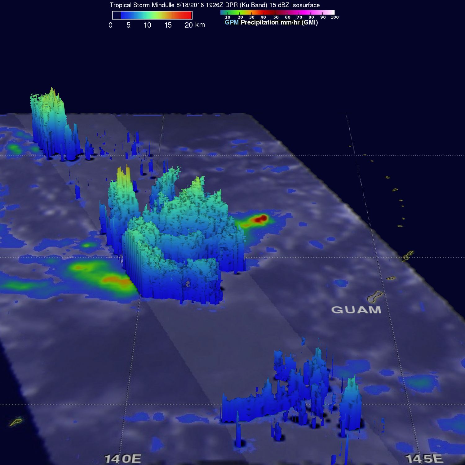
GPM's radar viewed strong convective storms in an area west of the forming tropical cyclone's center of circulation. 3-D measurements by GPM's radar (DPR Ku Band) showed that many storm tops in that area were reaching heights above 15 km (9.3 miles). Intense showers viewed by the satellite returned radar reflectivity values of over 82 dBZ.