
Intensifying Hurricane Kenneth Examined By GPM
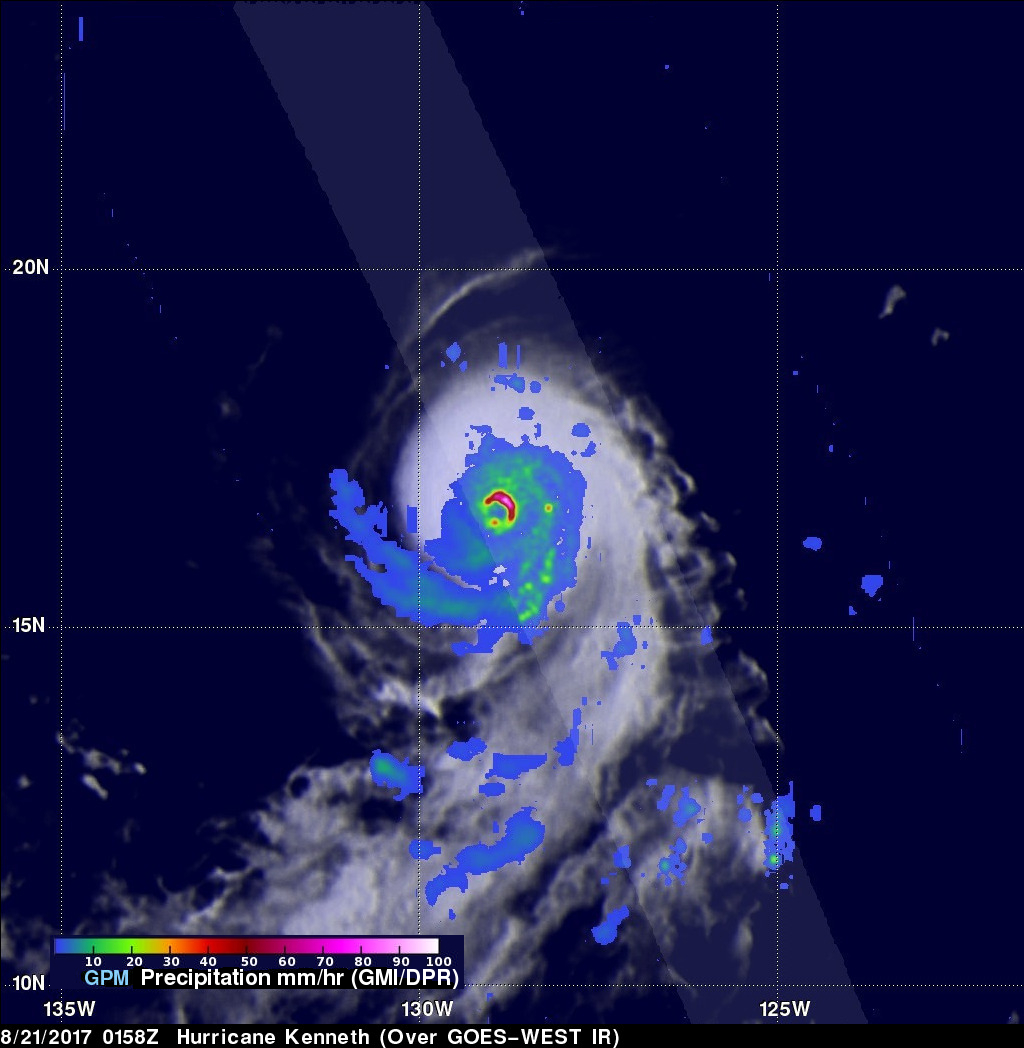
The GPM core observatory satellite flew over hurricane Kenneth when it was approaching it's peak power on August 21, 2017 at 0158 UTC. This rainfall map of hurricane Kenneth was derived from the GPM satellite's Microwave Imager (GMI) and Dual-Frequency Precipitation Radar (DPR) instruments. GPM's GMI data enables analysis of precipitation across a swath that is 550 miles (885 km) wide. GPM's radar (Ku Band) can be used to show three-dimensional maps of precipitation structure along a narrower 152 mile (245 km) swath. GPM's radar found rain falling at a rate of over 11.3 inches (286 mm) per hour in heavy downpours within Kenneth's eye wall.
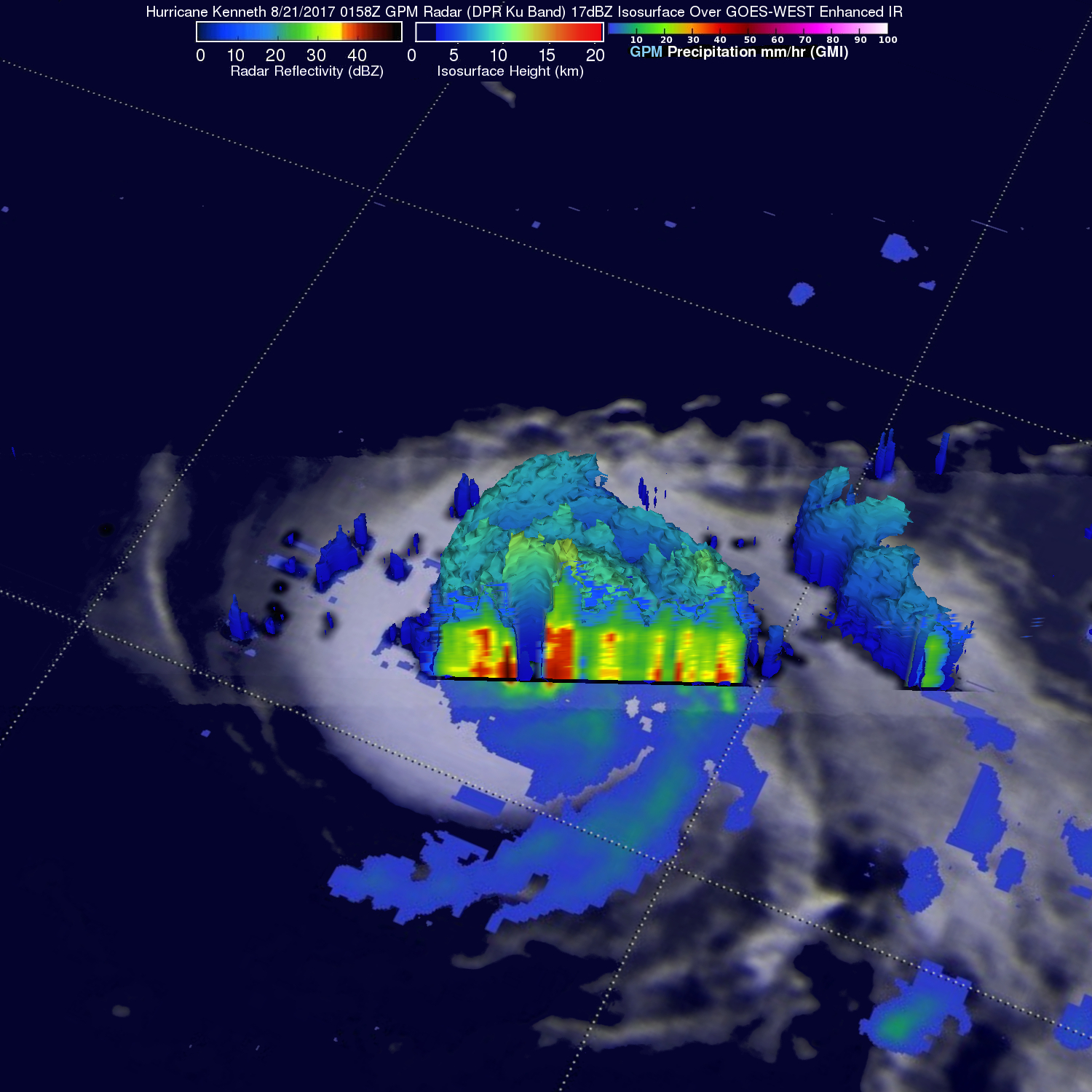
This GPM 3-D Radar slice (looking from the southwest) shows the vertical structure of precipitation in the center of hurricane Kenneth's eye. GPM's radar showed storm tops reaching heights above 8 miles (13 km) within Kenneth's eye wall.
Today hurricane Kenneth is rapidly weakening as it moves over cooler waters and encounters increasing southwesterly vertical wind shear. For a period of time on Monday Kenneth had winds of about 132 mph (115 kts) making it a powerful category four hurricane on the Saffir-Simpson hurricane wind scale. Only hurricane Fernanda, that occurred in late July, had higher winds in the eastern Pacific this year.