Intensifying South Pacific Tropical Cyclone Winston Viewed By GPM
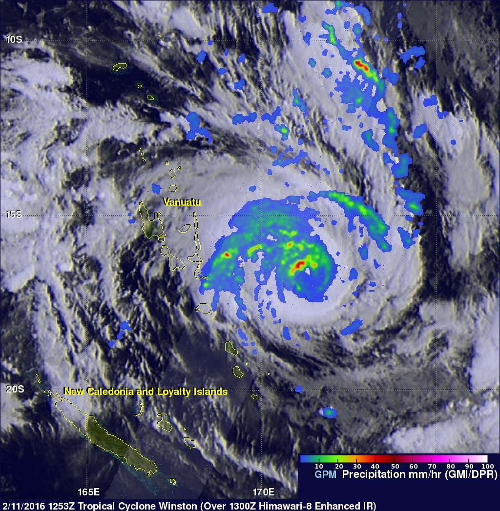
Tropical cyclone activity has recently increased in the South Pacific Ocean. Four tropical cyclones have formed in this area in 2016. The GPM core observatory satellite had an excellent view of tropical cyclone Winston on February 11, 2016 at 1253 UTC. Winston was located east of Vanuatu with tropical storm force winds of about 55 kts when GPM passed over head. Winston's rainfall was measured by GPM's Microwave Imager (GMI) and Dual-frequency Precipitation Radar (DPR) instruments. GPM's radar data revealed that Winston was dropping rain at a rate of over 60 mm (2.4 inches) per hour on the northwestern side of a forming eye wall.
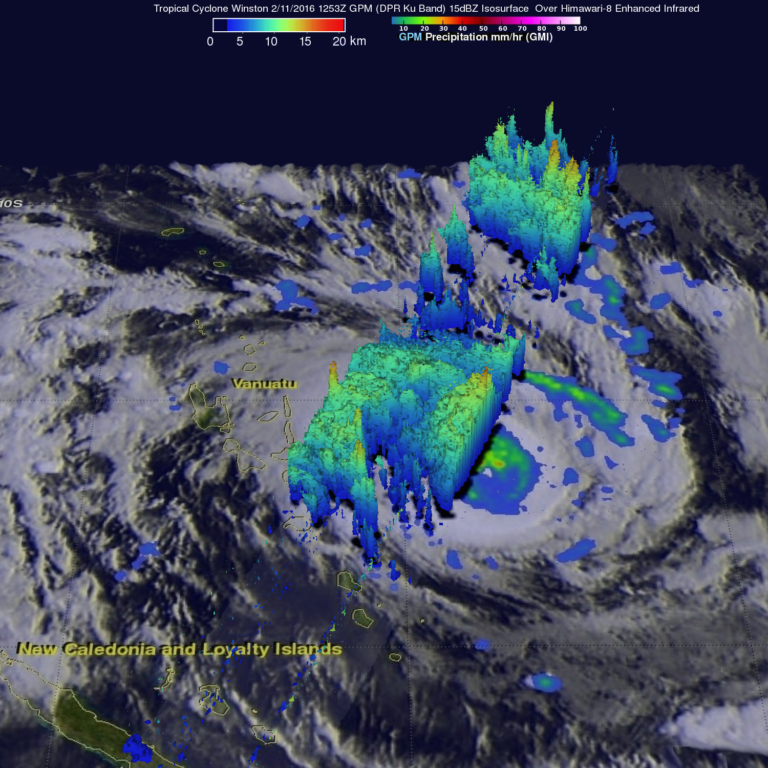
GPM's Radar data (DPR Ku Band) was used to analyze the 3-D structure of precipitation within tropical cyclone Winston. DPR found that cloud tops heights were reaching altitudes greater than 15 km (9.3 miles) in powerful convective storms in Winston's forming eye. The highest cloud tops were measured at a height of over 17 km (10.5 miles) in a feeder band well to the northeast of Winston's center of circulation. Tropical cyclone Winston is predicted to become much more powerful. Winston is predicted by the Joint Typhoon Warning Center (JTWC) to have winds of over 110 kts (127 mph) in a few days while moving toward the southeast of Vanuatu.


