
Intensifying Typhoon Chaba Examined By GPM
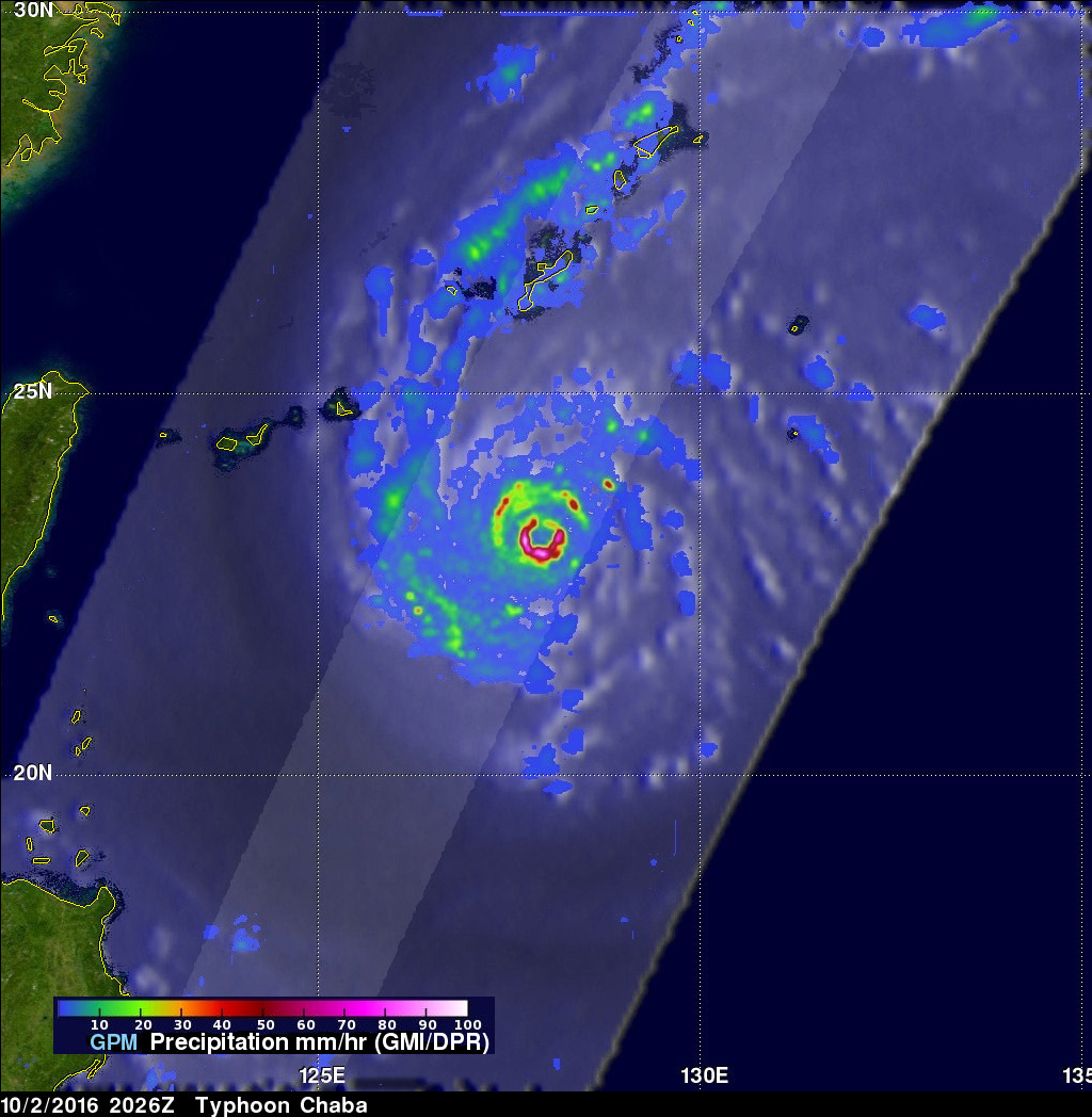
As Typhoon Chaba moved to the western Pacific Ocean south of Okinawa over the past few days wind speeds have increased to 115 kts (132 mph).The GPM core observatory satellite flew directly above Chaba’s eye on October 2, 2016 at 2026 UTC. GPM’s Microwave Imager (GMI) and Dual-Frequency Precipitation Radar (DPR) instruments showed that Chaba was dropping extremely heavy precipitation. Some precipitation in the typhoon’s small eye wall was measured by GPM’s radar falling at a rate of more than 234 mm (9,2 inches) per hour.
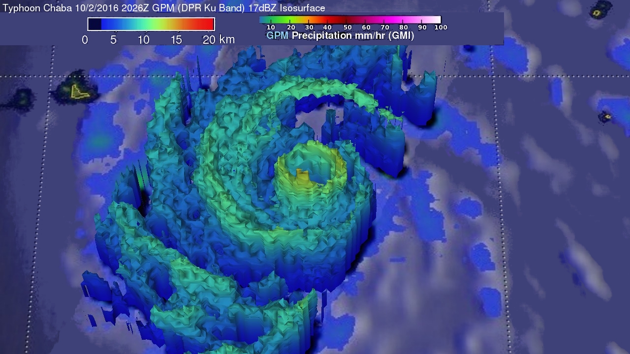
GPM’s Radar (DPR Ku Band) data were used to show the 3-D shape of precipitation inside typhoon Chaba. Some towering storm tops in Chaba’s eye wall were found by DPR to reach to almost 17 km (10.5 miles).
Warm sea surface temperatures and low vertical wind shear are two factors that are expected to help Typhoon Chaba become more powerful. Winds are predicted to peak at about 125 kts (144 mph) on October 3, 2016. Chaba is expected to weaken to about 70 kts (81 mph) before the typhoon hits southwestern Japan on about October 4, 2016.