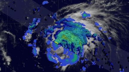
More Organized Tropical Storm Gert's Rainfall Examined by GPM
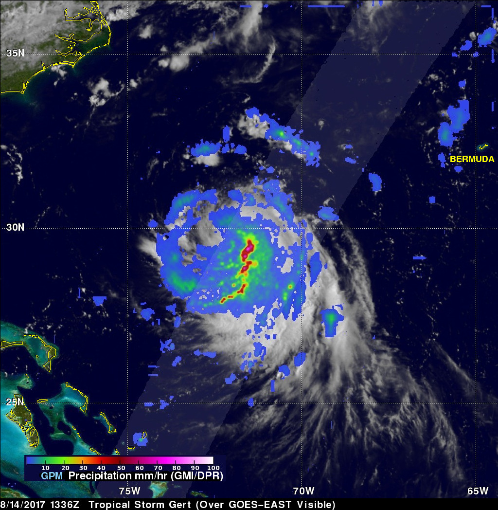
The GPM core observatory satellite passed above tropical storm Gert on August 14, 2017 at 9:36 EDT (1336 UTC) when winds had reached about 57.5 mph (50 kts). Data collected by GPM's Microwave Imager (GMI) and Dual-Frequency Precipitation Radar (DPR) instruments were used to show the coverage and the intensity of rainfall arround tropical storm Gert. The area covered by GPM's radar swath (shown in lighter shades) revealed that the most intense rainfall, measuring greater than 3.5 inches (90 mm) per hour, was located in bands of rain on the eastern side of the storm. This GPM pass was mentioned in a National Hurricane Center (NHC) Tropical Storm Gert Discussion where it said, "A recent 1336 UTC GMI overpass shows a large band of convection wrapping around the circulation ... ".
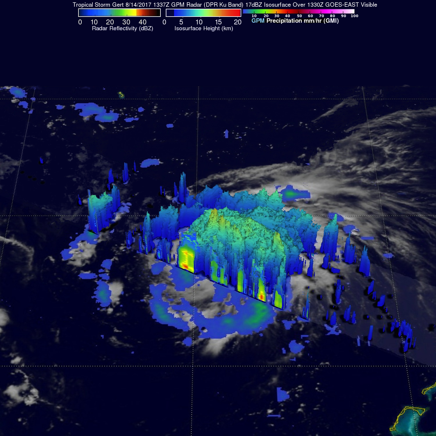
A 3-D cross-section view through tropical storm Gert was constructed from GPM's Radar (DPR Ku Band) data collected with this pass over Gert. This examination of the storm's 3-D precipitation structure showed that the tallest thunderstorms were located in an intense band of rain east of Gert's center. The tall thunderstorms in that band were shown by DPR to reach altitudes above 9.4 miles (15.2 km).
The NHC predicts that, despite moderate northerly vertical wind shear, tropical storm Gert will continue to intensify and become a hurricane Wednesday Morning. Gert is expected to travel toward the northwest over the open waters of the northern Atlantic Ocean and dissipate by Saturday August 19, 2017.