Oklahoma Mesoscale Convective System (MCS) Examined With GPM
The GPM Core observatory satellite's passed over Oklahoma on Monday, June 25, 2018 04:08 AM CDT (0508 UTC). The satellite makes measurements of precipitation with it's GPM's Microwave Imager (GMI) and Dual-Frequency Precipitation Radar (DPR) instruments every 95 minutes as it orbits the earth at 252.3 miles (407 km). The area covered by GPM's radar is shown in lighter shades.
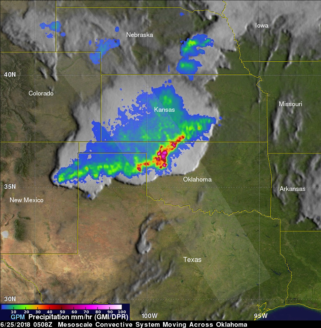
GPM passed directly over the center of a Mesoscale Convective System (MCS) that was moving across Oklahoma. GPM found that the MCS contained some intense storms. GPM's DPR can make accurate rainfall measurements along it's 151.9 mile (245km) swath to heights of 11.8 miles (19km). GPM's DPR measured rain falling at a rate of greater than 7.4 inches (188 mm) per hour in a few of the powerful storms that were located over northwestern Oklahoma.
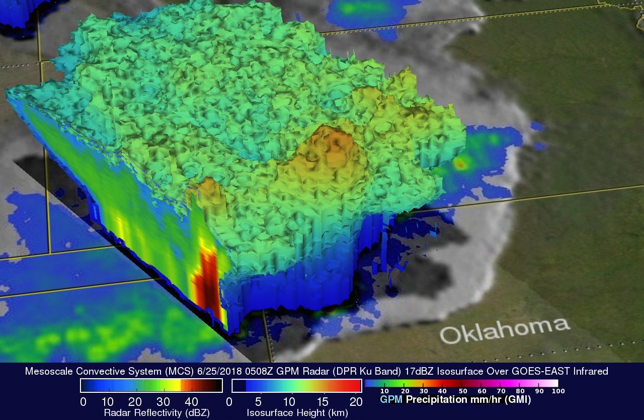
The GPM core observatory satellite's radar data (DPR ku Band) were used here to reveal the 3-D structure of precipitation within the storm system. GPM's radar revealed that that a few storm tops in this MCS were reaching heights of over 9.5 miles (15.4km).