Potential Tropical Cyclone (02L) Examined By GPM
A couple weeks after the official start of the Atlantic hurricane season the tropical Atlantic Ocean is starting to show potential tropical cyclone development. The National Hurricane Center (NHC) has indicated that potential tropical cyclone 02L, located east-southeast of Trinidad, will likely become a tropical storm within the next five days.
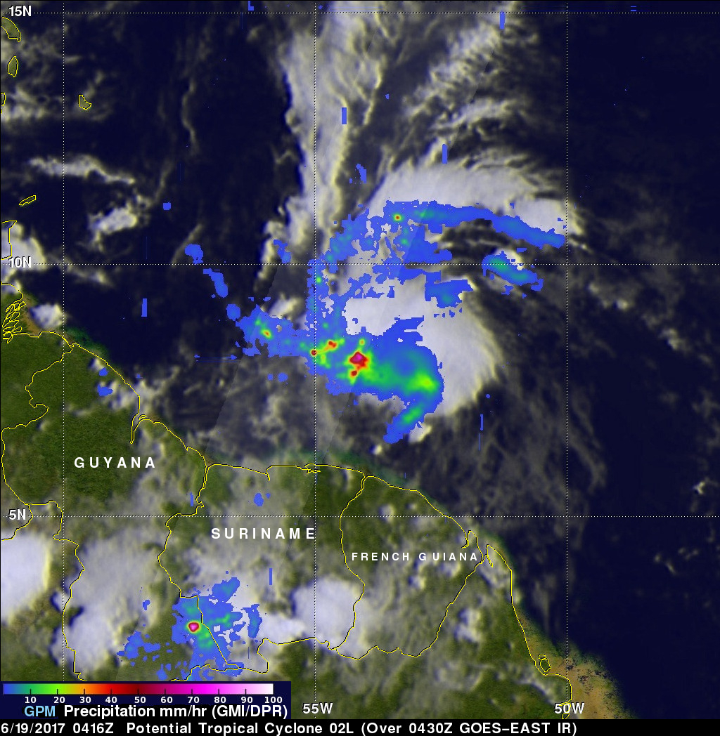
The GPM core observatory satellite flew above 02L on June 19, 2017 at 00:16 AM EDT (0416 UTC). Data collected by Microwave Imager (GMI) and Dual-Frequency Precipitation Radar (DPR) instruments showed that the potential tropical cyclone contained some heavy rain showers west of the low's center of circulation. Convective precipitation was falling at a rate of greater than 2.75 inches (70 mm) per hour in that area.
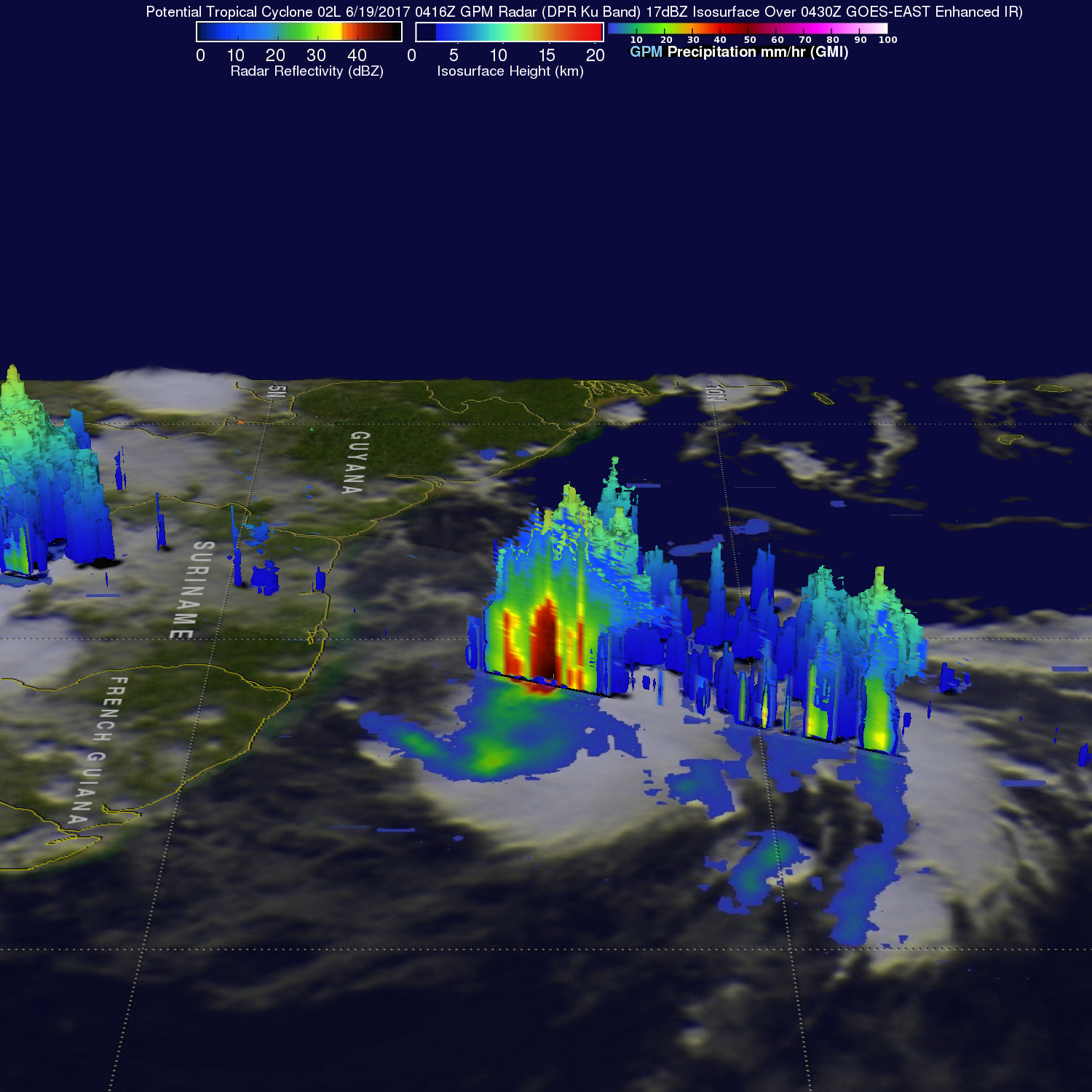
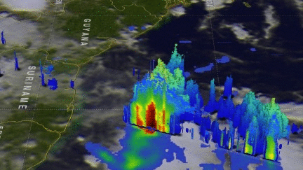
The second image was derived from GPM radar (DPR Ku Band) data collected at the same time. This image shows the 3-D height of the precipitation columns within the potential tropical cyclone (defined by the 17 dBZ isosurface). DPR revealed that the tallest towers within the strongest area of convection west of the center of circulation were reaching heights above 9.3 miles (15 km). A 3-D slice by GPM's radar through the tall storms show that heavy downpours were returning radar reflectivity values greater than 60 dBZ to the satellite.