
Potential Tropical Cyclone Nine Viewed By GPM
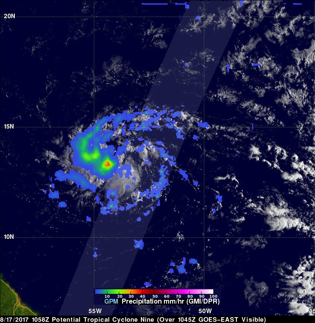
On Thursday August 17, 2017 at 1100 AM AST (1500 UTC) the National Hurricane Center (NHC) called a stormy area of low pressure east of the Antilles "Potential Tropical Cyclone Nine". The GPM core observatory satellite flew above this area of disturbed weather earlier at 6:58 AM AST (1058 UTC). GPM's Microwave Imager (GMI) and Dual-Frequency Precipitation Radar (DPR) data were used to examine the coverage and intensity of rainfall around the potential tropical cyclone. The center of the heaviest rainfall was located in GPM's GMI swath. Rain in that area was found by GMI to be falling at a rate of over 1.6 inches (41.7 mm) per hour. GPM's DPR scanned scattered precipitation east of the area of the most concentrated showers. DPR found rain coming down there at a rate of almost 1.8 inches (45 mm) per hour.
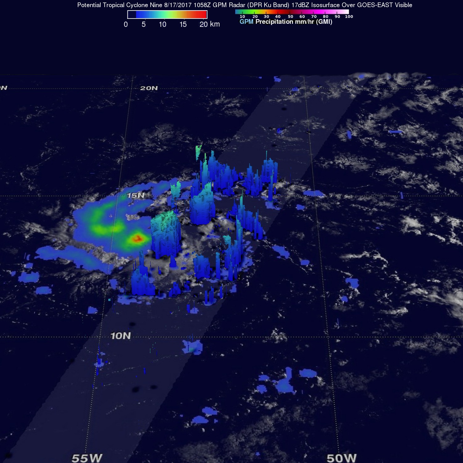
A 3-D slice by GPM's radar (DPR Ku Band) through the scattered storms to the east of the most intense storms showed that a few storm tops were reaching heights above 6.82 miles (11 km).