
Powerful Hurricane Ophelia Seen Heading Toward Ireland
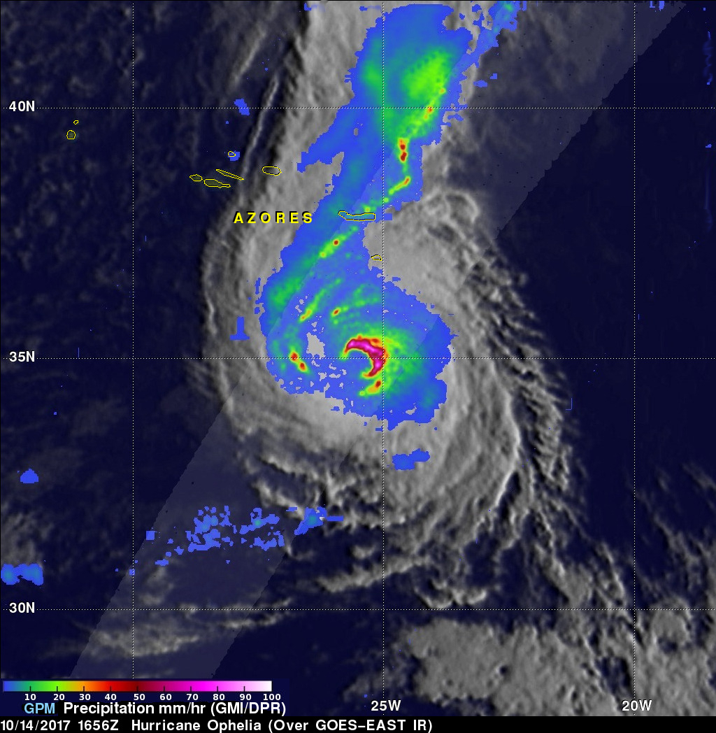
The GPM core observatory passed directly above hurricane Ophelia on October 14, 2017 at 1656 UTC. Ophelia was a powerful category three on the Saffir-Simpson hurricane wind scale with sustained winds of close to 115 mph (100 kts). GPM's Microwave Imager (GMI) and Dual-Frequency Precipitation Radar (DPR) instruments collected data showing the locations of extremely heavy rainfall with the hurricane. GPM's radar unveiled intense downpours in the northeastern side of Ophelia's eye that were dropping rain at the extreme rate of over 8.4 inches (213 mm) per hour. Other intense feeder bands with Ophelia were often shown by GPM producing rain at a rate of over 3.9 mm (100 mm) per hour.
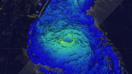
This 3-D animation reveals the height of precipitation within hurricane Ophelia. The animation was produced by combining data from GPM's radar (DPR Ku band) with heights of cloud tops based on GOES-EAST satellite image temperatures. Storm tops in the northeastern side of Ophelia's eye wall (bright yellow) were shown by GPM's radar reaching heights of above 7.6 miles (12.4 km). The structure of hurricane Ophelia's eye wall is clearly shown with this close-up virtual flyby above the center of the tropical cyclone.
Hurricane Ophelia was weakening on October 15, 2017 and expected to transition to an extratropical low by Monday October 16, 2017. Ophelia was predicted to be a powerful storm when it reached Ireland on Monday. The storm was predicted by the National Hurricane Center (NHC) to bring strong winds to the area on Monday.