Powerful Typhoon Goni Brushing The Philippines
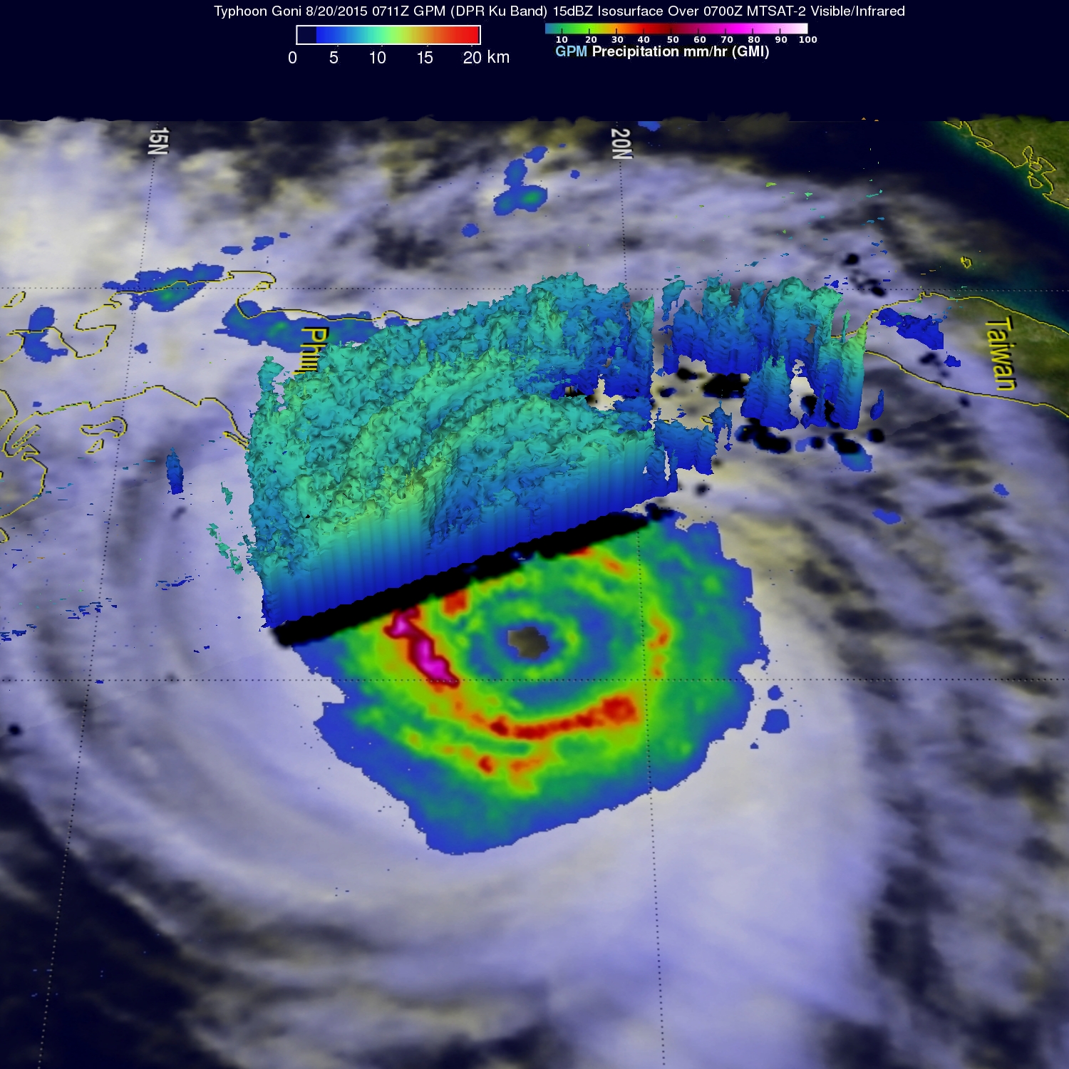
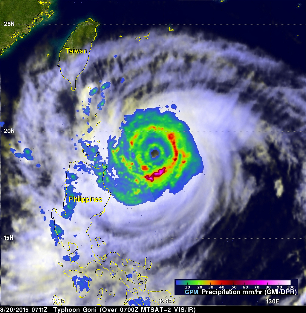
Rain bands from typhoon Goni were hitting the island of Luzon in the northern Philippines when the GPM core observatory satellite flew over on August 20, 2015 at 0711 UTC (3:11 PM Philippine Standard Time). GPM's Microwave Imager (GMI) clearly showed the intensity of rain falling in Goni's inner and replacement outer eye wall. GMI found that precipitation was falling at a rate of over 88.0 (3.5 inches) in extreme rainfall south of Goni's distinct eye.
Radar reflectivity data from GPM's Dual-Frequency Precipitation Radar (DPR) instrument was used in this view (from the east) to show the 3-D vertical structure of rainfall bands in the western side of the typhoon.
The Joint Typhoon Warning Center (JTWC) predicts that the center of typhoon Goni will pass to the north of the Philippines and re-curve to pass to the east of Taiwan. Goni's winds were about 115 kts (132 mph) at the time of this GPM view and are predicted to increase to about 125 kts (144 mph) tomorrow when the typhoon is just north of the Philippines.