
Rapidly Intensifying Typhoon Examined By GPM
The first typhoon of 2016 called Nepartak developed in the western Pacific Ocean on July 3, 2016 south of Guam. Nepartak has moved to the west-northwest of Guam and has started to rapidly intensify. Warm water, low vertical wind shear and favorable outflow due an upper level trough are providing favorable environmental conditions for the typhoon.
The GPM core observatory satellite flew above Nepartak on July 4, 2016 at 2151 UTC when the tropical cyclone was still classified as a tropical storm. GPM's Microwave Imager (GMI) and Dual-Frequency Precipitation Radar (DPR) data showed that Nepartak was very close to forming an eye at that time. Very powerful storms near the center of Nepartak's circulation were found to be dropping rain at a rate of over 193 mm (7.6 inches) per hour.
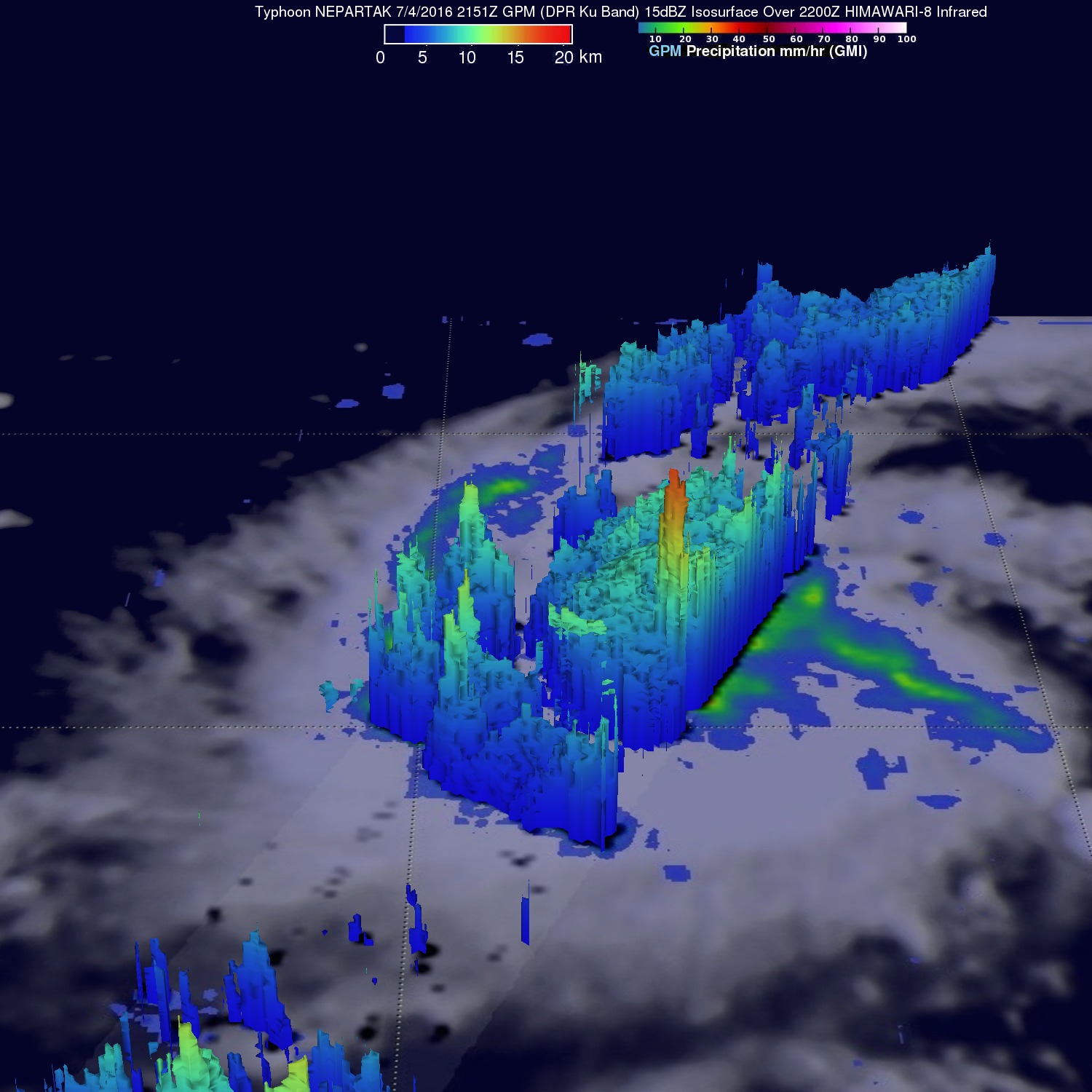
GPM radar sliced through tropical storm Nepartak and measured the 3-D vertical structure of very tall thunderstorm towers near the center of the intensifying tropical storm. These tall thunderstorms called "hot towers" were found to reach heights of 17.0 km (about 10.5 miles). These powerful storms near the center of a tropical cyclone are often seen prior to intensification. Energy released by rainfall into the center of a tropical cyclone provides the energy upon which tropical cyclones thrive.