Severe Weather In Tornado Alley And Eastward
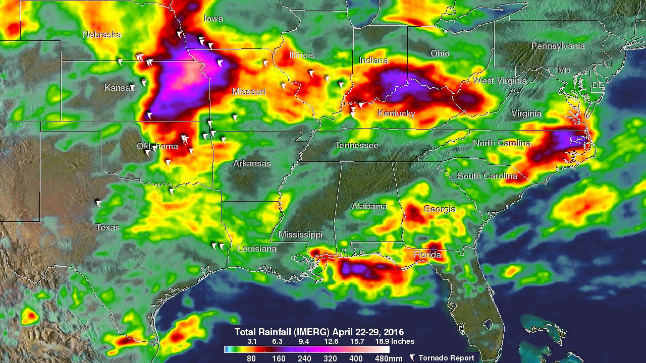
Severe spring thunderstorms frequently spawned tornadoes from the Gulf Coast north and eastward during the past week. Gulf moisture clashing with frontal systems moving over the United States provided much of the fuel for intense showers and severe thunderstorms. Flash flooding was often the result of the sudden onset of extremely heavy rainfall. Over 305 mm (12 inches) of rain was reported in southern Mississippi in a few hours one morning on April 28, 2016.
NASA's Integrated Multi-satellitE Retrievals for GPM (IMERG) data were used to estimate the amount of rain that fell from April 22-29, 2016. Rainfall totals greater than 305 mm (12 inches) were analyzed in several areas over the United States from Kansas to the East Coast. The highest totals (light purple) were indicated near the conjunction of the states of Kansas, Nebraska and Missouri. Indiana, Kentucky, Ohio and North Carolina were also the recipients of heavy rainfall.
From April 22-29, 2016 there were over 48 tornadoes in the United States reported to the National Oceanic and Atmospheric Administration (NOAA). The locations of some of these tornadoes are shown overlaid in white on this IMERG rainfall analysis.