
Subtropical Storm Joaquin Heads For Europe
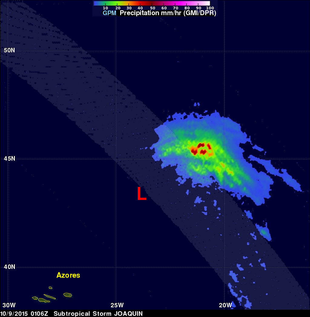
Hurricane Joaquin became subtropical while traveling over the cool waters of the North Atlantic. The low pressure center that was once powerful hurricane Joaquin was viewed by the GPM core observatory satellite on October 9, 2015 at 0106 UTC. The low pressure center was moving past the Azores toward landfall in Portugal. GPM's Microwave Imager (GMI) and Dual-Frequency Precipitation Radar (DPR) instruments measured precipitation within the low pressure center. The most intense rainfall was located northeast of the center of the low and was falling at a rate of over 54 mm (1.1 inches) per hour.
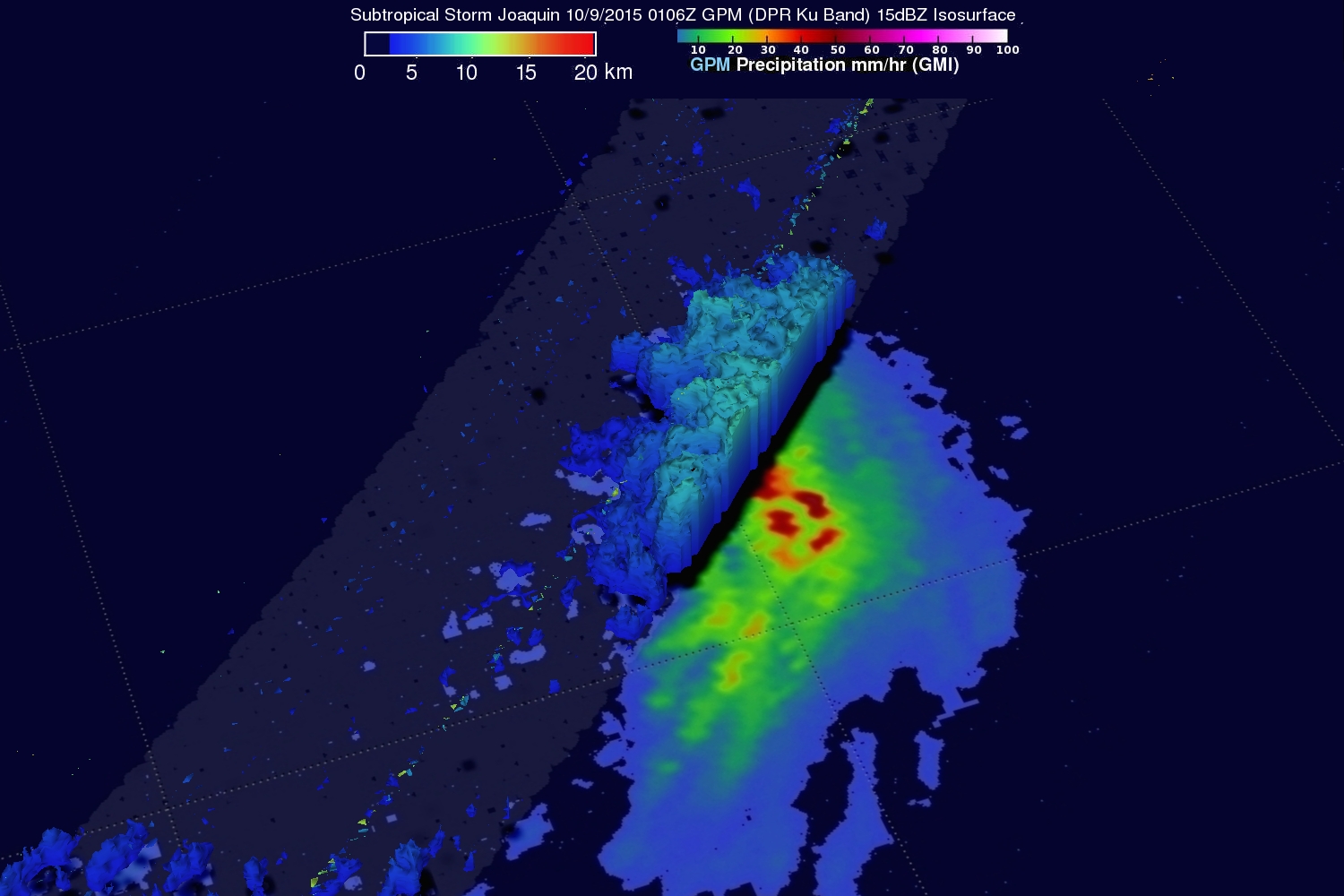
Although the low pressure center has lost much of the energy that was present when it was a hurricane it still contains several strong thunderstorms. A 3-D view provided by GPM's radar (DPR Ku band) shows that storm tops are fairly low but some radar reflectivity values of over 40 dBZ were returned to the satellite as it sliced through the low.