
Tropical Cyclone 05S Viewed By GPM
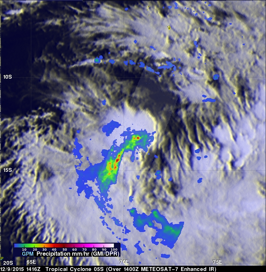
Tropical cyclone 05S formed today in the South Indian Ocean well to the northeast of the islands of Reunion and Mauritius. The GPM core observatory satellite had a perfect view of 05S when the satellite flew over on December 9, 2015 at 1416 UTC. At that time the forming tropical cyclone had sustained winds estimated at 35 kts (40 mph). GPM found that 05S was dropping rain at a rate of over 77 mm (~ 3 inches) per hour in strong convective storms near the tropical cyclone's center of circulation. GPM also saw intense rainfall in a strong feeder band that was converging into the storm's southwestern side.
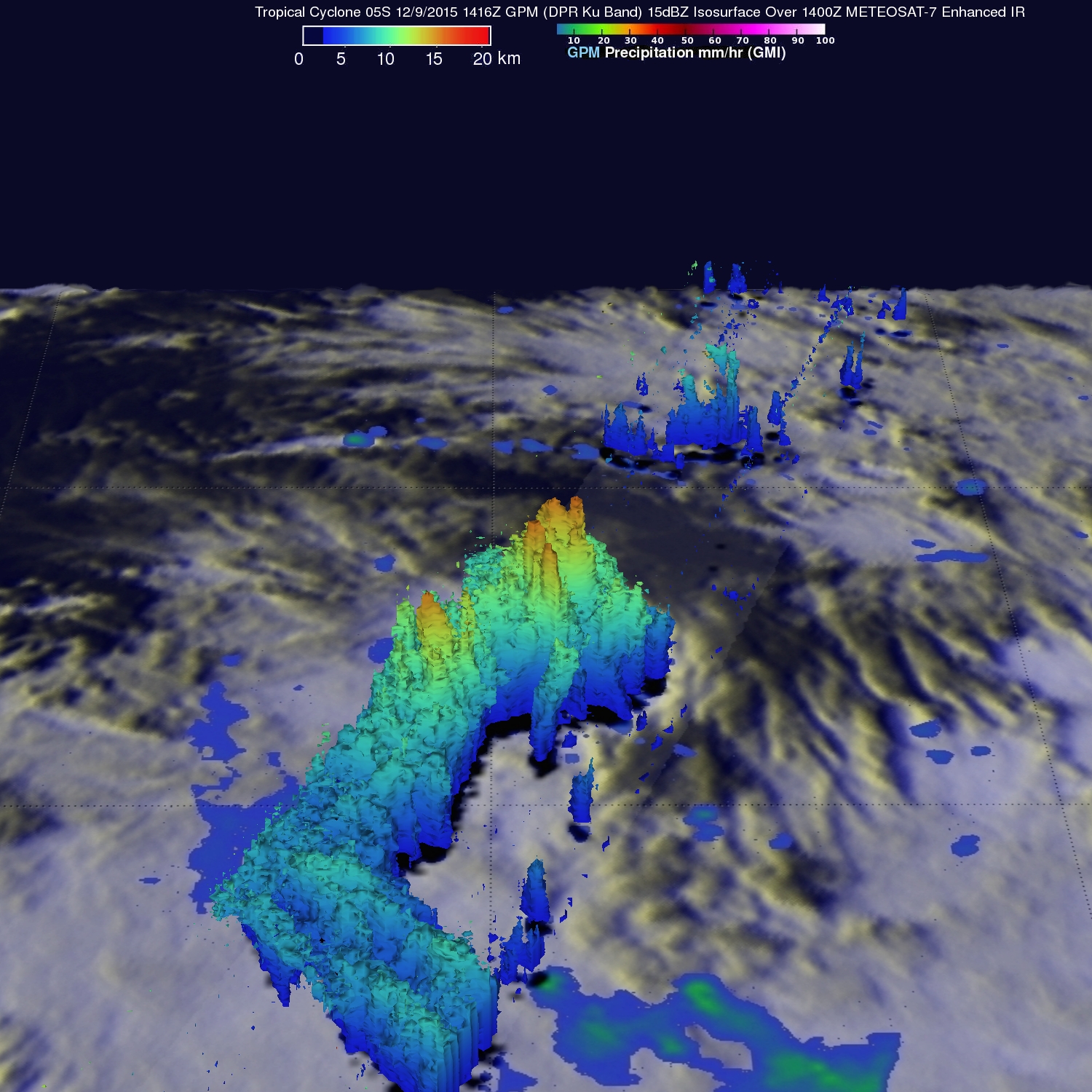
This 3-D image that was derived from GPM's Radar (DPR Ku Band) shows the structure of precipitation within tropical cyclone 05S. GPM measured thunderstorm tops reaching heights above 16.6 km (10.3 miles) near the center of the developing tropical cyclone. The Joint Typhoon Warning Center (JTWC) predicts that 05S will move toward the southwest and become more powerful with winds of 50 kts (58 mph) on December 11, 2015.