
Tropical Cyclone Ashobaa Contains Powerful Storms
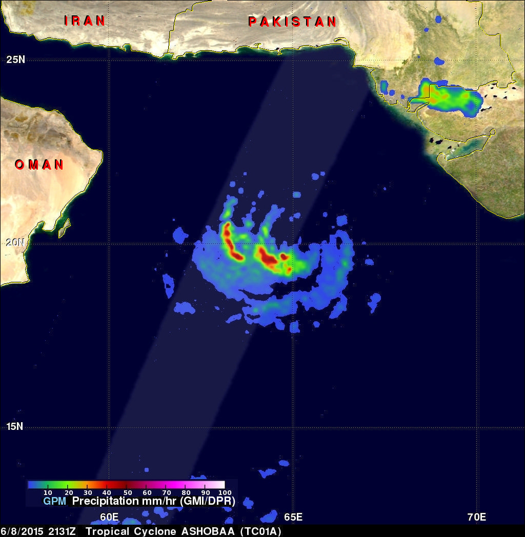
The GPM core observatory had another excellent view of tropical cyclone Ashobaa in the Arabian Sea over on June 8, 2015 at 2131 UTC. As expected, Ashobaa was more powerful than when seen by GPM earlier in the day. GPM's Microwave Imager (GMI) and Dual-Frequency Precipitation Radar (DPR) instruments showed that rain was falling at a rate of over 70.5 mm (about 2.8 inches) per hour in bands of storms west of the center of circulation.
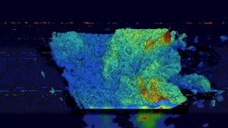
Very powerful storms were seen west of tropical cyclone Ashobaa's center of circulation by GPM's Ku Band Radar. A 3-D view constructed from GPM's Ku band radar data shows that Ashobaa had some extremely tall storms. GPM radar data indicated that some of these very intense storms were reaching the amazing height of 21 km (13 miles).
Tropical cyclone Ashobaa is predicted by the Joint Typhoon Warning Center (JTWC) to have peak wind speeds of 65 kts (75 mph) while moving over the open waters of the Arabian Sea. This would make ASHOBAA the equivalent of a category one hurricane on the Saffir-Simpson hurricane wind scale. Ashobaa is expected to weaken to tropical storm intensity with winds of 50 kts (58 mph) before hitting northern Oman in a few days.