Tropical Cyclone Ava's Disastrous Rainfall Measured With IMERG
Tropical cyclone Ava dropped extremely heavy rainfall over Madagascar as it passed over the eastern side of the island country from January 5-6, 2018. Ava's drenching rainfall caused flooding and landslides which resulted in the deaths of at least 29 people. An estimated 80,000 people on Madagascar were affected by the tropical cyclone.
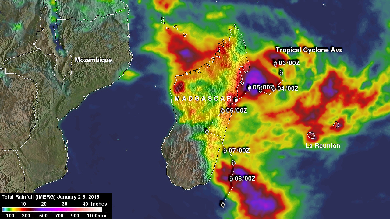
This rainfall analysis was produced by accumulating rainfall that fell near Madagascar during the period from January 2-8, 2018. These IMERG estimates showed the locations of extreme rainfall totals during the period when tropical cyclone Ava was in Madagascar's vicinity. The highest IMERG rainfall accumulation estimates of close to 700mm (27.6 inches) were shown for this period in the Indian Ocean northeast and southeast of Madagascar. The highest rainfall over land was indicated in northeastern Madagascar where Ava came ashore. High rainfall totals over land were also indicated by IMERG over northwestern Madagascar where the tropical cyclone caused an onshore flow from the Mozambique Channel.
IMERG data are normally produced at Goddard Space Flight Center within 6 hours of the data being acquired. NASA's Precipitation Processing System produced those data used in this analysis from the satellites in the GPM Constellation. IMERG data are calibrated with measurements from the GPM Core Observatory as well as rain gauge networks around the world.
Ava has moved into the Indian Ocean south of Madagascar and is encountering cooler ocean waters. These environmental conditions are expected to cause Ava to rapidly dissipate.