
Tropical Cyclone Fantala Formation Seen By GPM
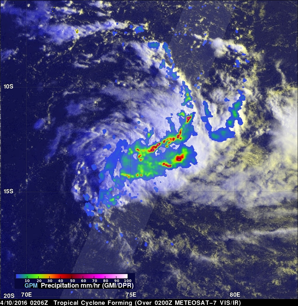
A tropical cyclone called Fantala formed in the South Indian Ocean far to the east of Madagascar on on April 11, 2016. Fantala has slowly intensified while moving westward and is expected become even more powerful. The GPM core observatory satellite flew over Fantala (TC19S) on April 10, 2016 at 0206 UTC when the tropical cyclone was forming. The first image shows a rainfall analysis using data captured with by GPM's Microwave Imager (GMI) and Dual-Frequency Precipitation Radar (DPR) instruments. GPM rainfall is shown overlaid on a 0200Z METEOSAT-7 Visible and Infrared image. Intense convective thunderstorms a were dropping rain a rate of over 165 mm (6.5 inches) per hour in the organizing tropical cyclone.
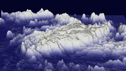
On April 10, 2016 GPM's radar (DPR) revealed through cloud cover that thunderstorms towers were reaching heights of almost 16 km (9.9 miles).
On April 10, 2016 GPM's radar (DPR) revealed through cloud cover that thunderstorms towers were reaching heights of almost 16 km (9.9 miles).
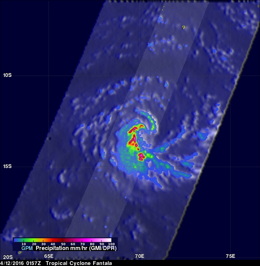
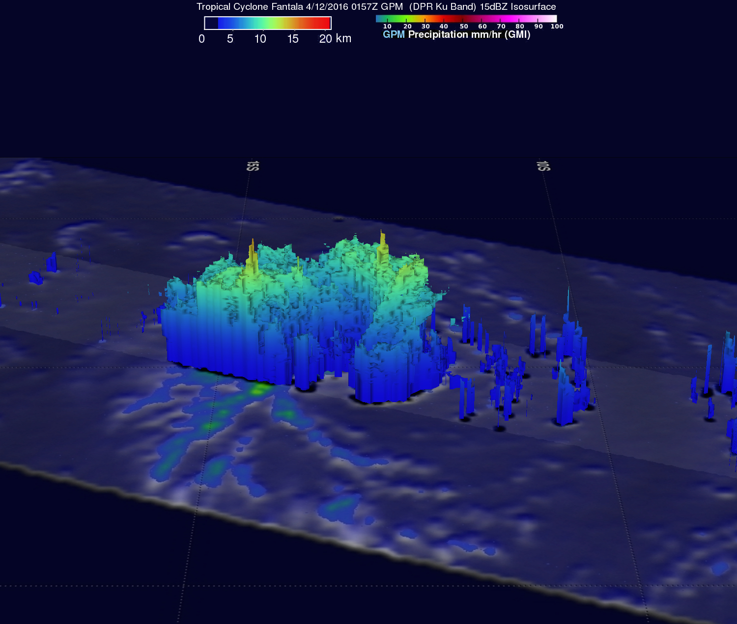
On April 12, 2016 at 0157 UTC GPM again had a good view of tropical cyclone Fantala when sustained wind speeds had increased to about 45 kts (52 mph). Fantala was getting better organized with GPM showing intense bands spiraling into the center. Precipitation was found by GPM dropping rain at a rate of 189 mm (7.4 inches) per hour in these feeder bands. GPM's radar (DPR) found powerful thunderstorms reaching altitudes of over 16 km (9.9 miles).
The Joint Typhoon Warning Center (JTWC) predicts that tropical cyclone Fantala will intensify and have maximum sustained winds of 120 kts (138 mph) in a few days. Fantala is expected to continue heading toward the west and may be a concern for northern Madagascar after April 17, 2016.