
Tropical Cyclone Fantala's Changes Observed By GPM

As expected, tropical cyclone Fantala reversed course and moved southeastward almost directly over it's earlier track. The tropical cyclone's intensity also fluctuated. Maximum winds dropped significantly as Fantala moved southeastward but have rebounded somewhat today. The GPM core observatory satellite flew over the tropical cyclone on April 19, 2016 at 1346Z when winds had dropped to about 95 kts (109 mph). At that time GPM's Microwave Imager (GMI) and Dual-Frequency Precipitation Radar (DPR) found that Fantala still contained extremely heavy rainfall in storms spiraling into the tropical cyclone's northwestern side. GPM's radar (DPR) detected some heavy showers in that area that were dropping rain at a rate of over 209 mm (8.2 inches) per hour.
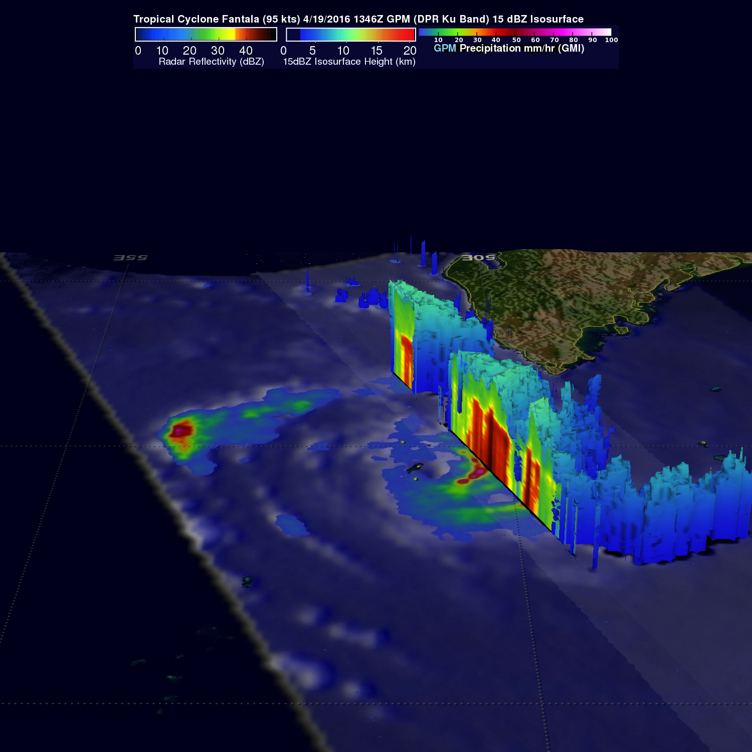
Data from GPM's radar (DPR Ku band) were used to show a 3-D cross section through the most intense rainfall within tropical cyclone Fantala. This view, looking toward the south, showed where strong showers in these bands were returning echoes greater than 53 dbz to the satellite.
The Joint Typhoon Warning Center (JTWC) predicts that Fantala's winds will gradually decrease to tropical storm force over the next five days and that the tropical cyclone will circle back to the north of Madagascar.