
Tropical Cyclone Josie's Deadly Flooding Rainfall Examined With IMERG
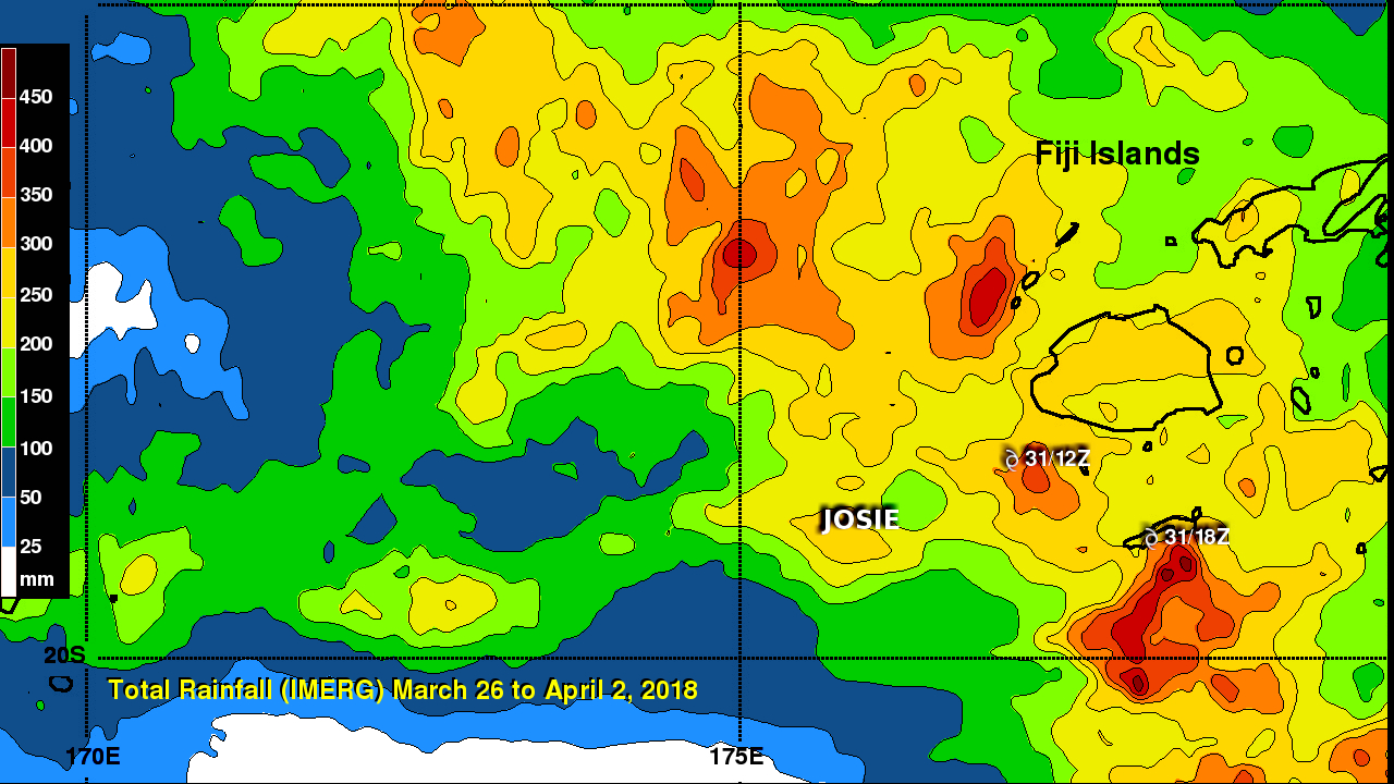
Tropical cyclone Josie didn't make landfall in Fiji but it's heavy rainfall resulted in deadly flooding. Approximate locations of tropical cyclone Josie, as it moved close to Fiji, are shown overlaid in white. Josie's clockwise circulation streamed moisture over Fiji causing flooding that led to the deaths of at least four people. This rainfall accumulation analysis used Integrated Multi-satellitE Retrievals for GPM (IMERG) data. Those data are generated by NASA's Precipitation Processing System every half hour within about 6 hours from when data are acquired. IMERG data are acquired from the satellites in the GPM Constellation. Those data are calibrated using the GPM core observatory's Microwave Imager (GMI) and Dual Frequency Precipitation Radar (DPR) as the standard. This IMERG analysis shows the locations of rainfall during the period from March 26 to April 2, 2018. During this period tropical cyclone Josie formed and passed by close to the southwest of Fiji and then to the southeast. IMERG data indicated that rainfall totals of greater than 250 mm (9.8 inches) occurred over large parts of Fiji. IMERG also indicated that tropical cyclone Josie produced extreme rainfall totals greater than 450 mm (17.7 inches) in some areas along the storm's track.