Tropical Cyclone Mekunu Examined With GPM Satellite
The second tropical cyclone in less than a week has formed in the western Arabian Sea early on May 22, 2018. This tropical cyclone called MEKUNU is intensifying as it heads toward Oman. The Joint Typhoon Warning Center (JTWC) predicts that MEKUNU will have winds of about 85 kts (98 mph) when it hits southwestern Oman in about three days. This will make it the equivalent of a category two hurricane on the Saffir-Simpson hurricane wind scale. Tropical cyclone MEKUNU follows on the heels of destructive and deadly tropical cyclone SAGAR that just made landfall over northwestern Somalia a few days ago.
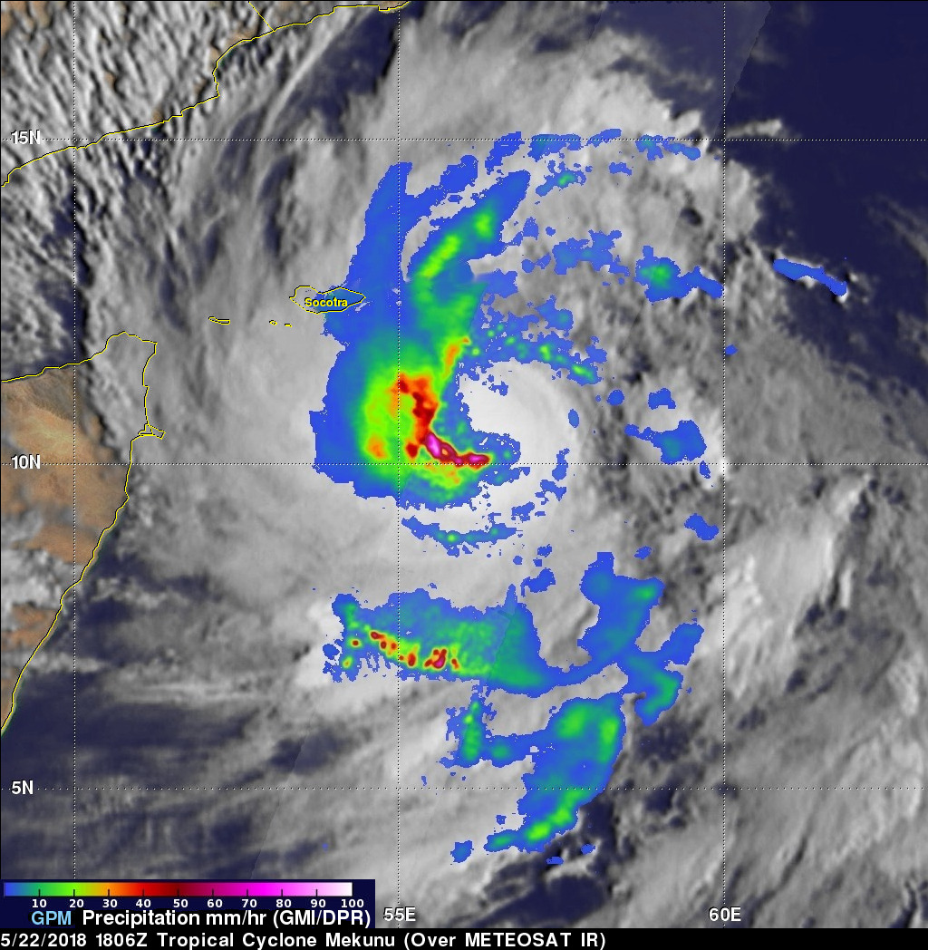
The GPM core observatory satellite flew above tropical cyclone MEKUNU in the Arabian Sea on May 22, 2018 at 1806 UTC. GPM's Microwave Imager (GMI) and Dual Frequency Precipitation Radar (DPR) instruments collected data that showed the intensity and location of precipitation within the intensifying tropical cyclone. This GPM pass showed that MEKUNU was becoming well organized with maximum sustained wind speeds greater than 45 kts (52 mph). GPM showed that extremely heavy rainfall was located southwest of the center of circulation. GPM's radar (DPR Ku Band) measured precipitation that was falling at a rate of almost 180 mm (7.1 inches) in a few powerful convective storms.
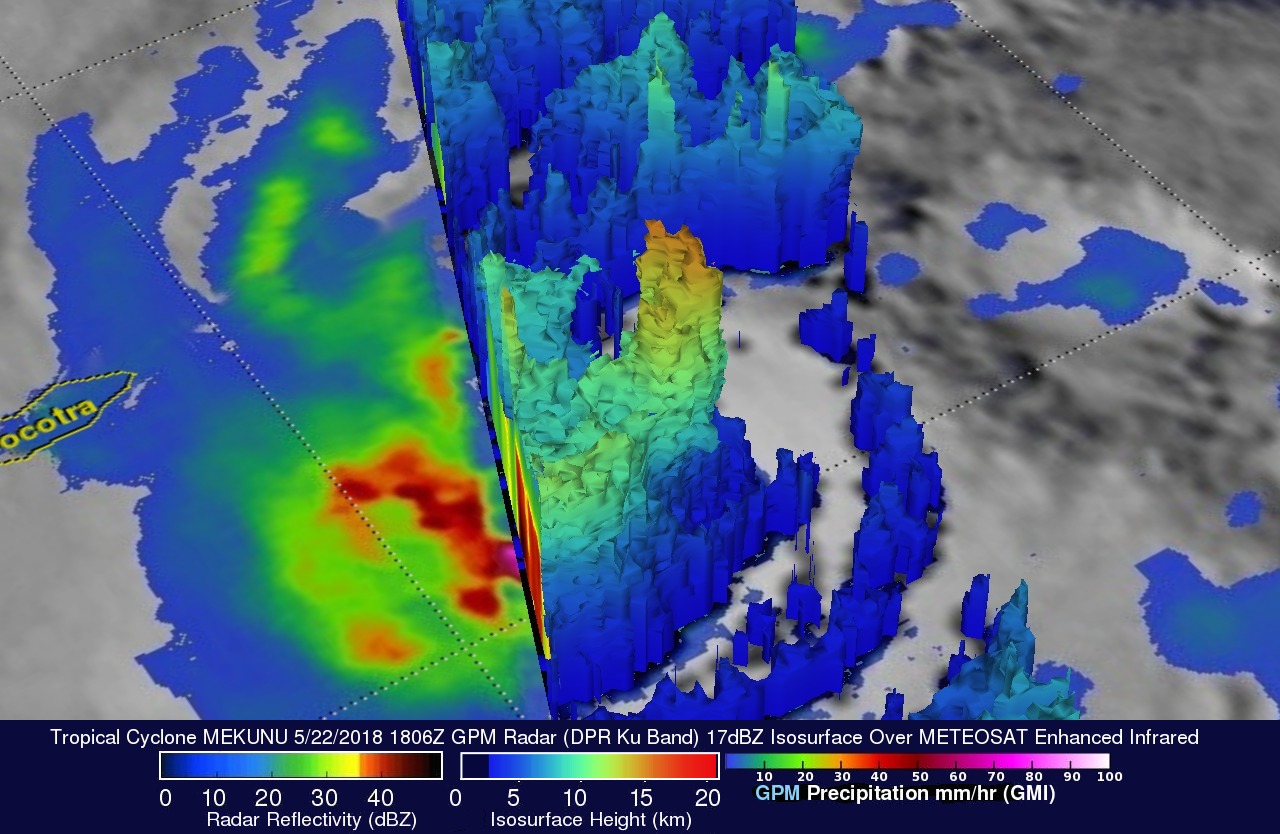
The GPM satellite's radar (DPR Ku Band) data were used here to show the 3-D structure of precipitation within tropical cyclone MEKUNU. This 3-D cross-section view of the tropical cyclone's precipitation revealed that powerful convective storms southwest of MEKUNU's center were reaching heights of about 16 km (9.9 miles). GPM's DPR showed that some heavy downpours were returning radar reflectivity values greater than 59 dBZ to the satellite.