Tropical Cyclone Ockhi's Rainfall Examined By GPM
On December 2, 1027 OCKHI became the first tropical cyclone of the year to form in the Arabian Sea. Fortunately for India the tropical cyclone remained off India's southwestern coast. OCKHI intensified to the equivalent of a category 3 hurricane on the Saffir-Simpson hurricane wind scale before it started to weaken. Vertical wind shear caused OCKHI to weaken as the tropical cyclone started moving north-northeastward toward India's Gulf of Khambhat.
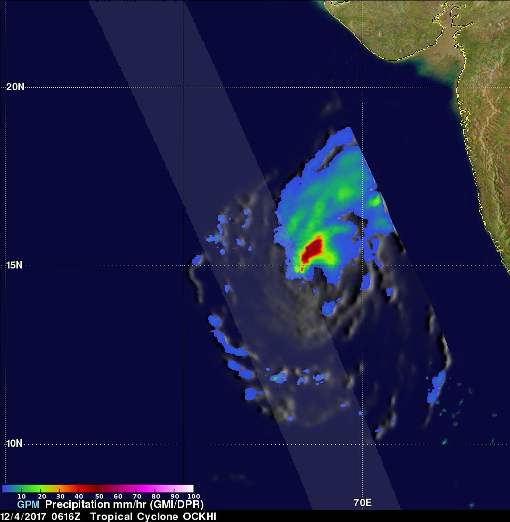
NASA's GPM Core Observatory satellite passed over tropical cyclone OCKHI on December 4, 2017 at 0616 UTC. The rainfall coverage shown here was derived from data collected by GPM's Microwave Imager (GMI) and Dual-Frequency Precipitation Radar (DPR) instruments. Those data showed that very heavy rainfall was being produced by powerful storms northwest of OCKHI's eye. GPM's GMI found rain falling at a rate of over 62 mm (2.44 inches) per hour in these storms. GPM's radar (DPR Ku Band) sliced through the western side of the tropical cyclone. DPR found that powerful storms on that side of OCKHI were dropping precipitation at a rate of over 60 mm (2.27 inches) per hour.
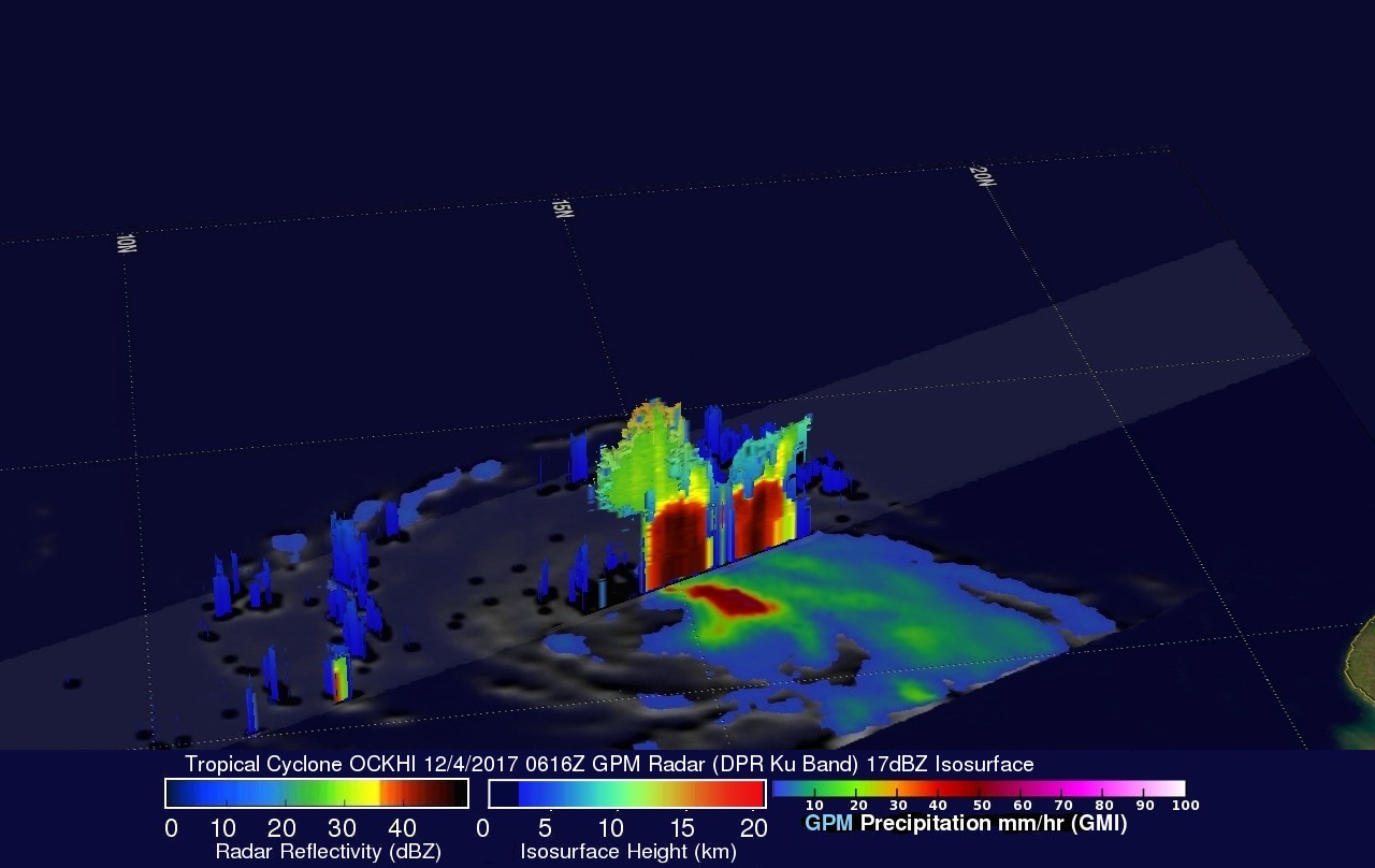
This 3-D view of tropical cyclone OCKHI used GPM's radar (DPR Ku Band) data. This slice through the western side of tropical cyclone OCKHI showed storm tops reaching height above 16 km (9.92 miles). This 3-D cross-section by GPM's DPR revealed that many radar reflectivity values were greater than 50 dBZ within downpours on the western side of the tropical cyclone.