Tropical Disturbance Threatens India and Bangladesh
A tropical disturbance that recently formed in the Bay Of Bengal may cause heavy rainfall in the next few days along coastal India's eastern state of Odisha and southern Bangladesh. The low is predicted to move northeastward over the warm waters of the Bay Of Bengal but according to the Joint Typhoon Warning Center (JTWC) has only a medium chance of developing into a tropical cyclone. High vertical wind shear is forecast to keep the tropical disturbance from intensifying.
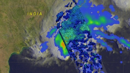
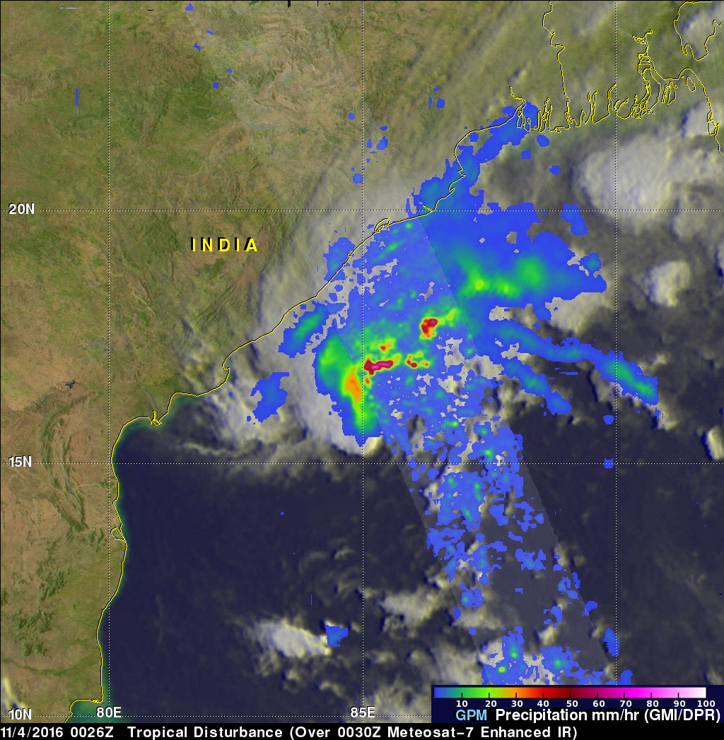
The GPM core observatory flew above the low on November 4, 2016 at 0026 UTC. GPM saw that the low contained some strong convective thunderstorms. Rainfall was examined in the low with data collected by GPM's Microwave Imager (GMI) and Dual-Frequency Precipitation Radar (DPR) instruments. GPM's radar (DPR Ku Band) revealed that storms on the southern side of the tropical disturbance were dropping rain at a rate of almost 185 mm (7.3 inches) per hour.
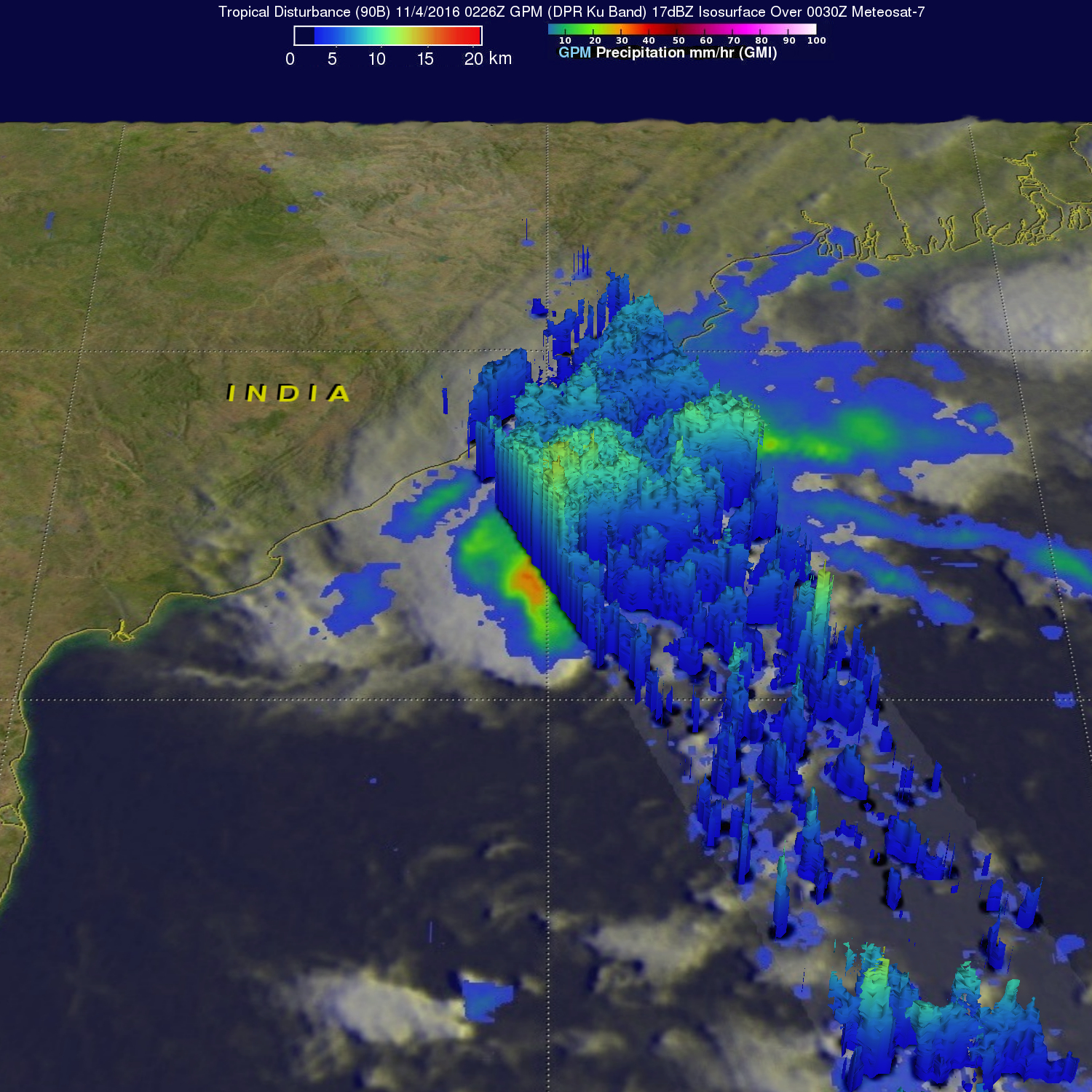
This view reveals the 3-D structure of rainfall within the tropical disturbance. It shows that some powerful storms within the low had tops that were reaching heights above 15 km (9.3 miles). Downpours within the stormy area were returning radar reflectivity values of over 57dBZ. These measurements supplied further evidence of the intensity of rainfall in this area of the Bay Of Bengal.