
Tropical Storm 14W Examined By The GPM Satellite
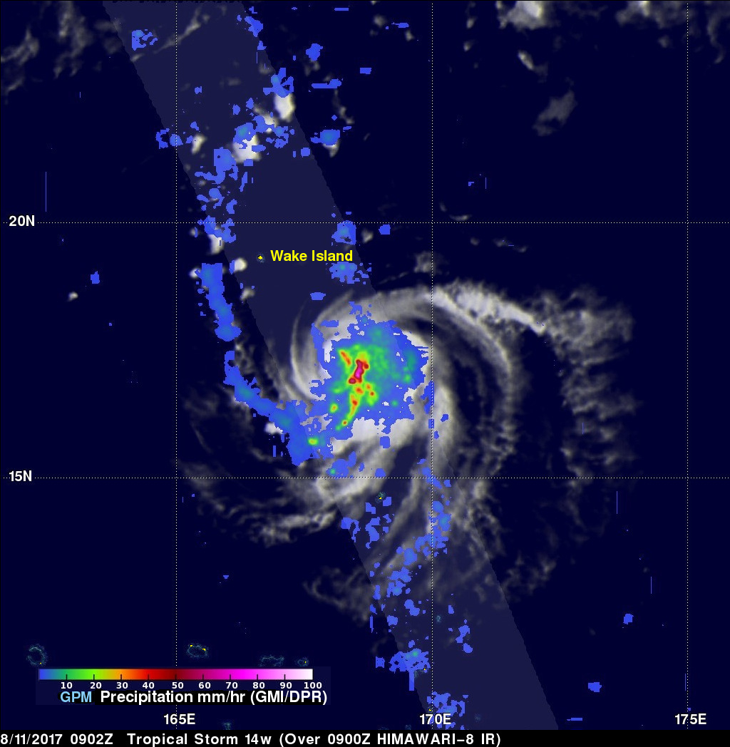
Tropical storm 14W formed in a remote area of the western Pacific Ocean southeast of Wake Island on August 11, 2017. The GPM core observatory satellite flew above the center of the newly formed tropical storm on August 11, 2017 at 0902 UTC. The "core" satellite carries advanced radar and radiometer systems that measure precipitation from space and serves as a standard that is used to unify precipitation measurements from a constellation of research and operational satellites.
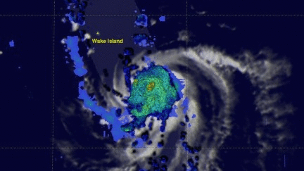
Tropical storm 14W was revealed by GPM to be small but well organized with very intense convective storms near the tropical cyclone's center of circulation. This image shows precipitation measurements that were derived from data collected by GPM's Microwave Imager (GMI) and Dual-Frequency Precipitation Radar (DPR) instruments. GPM's DPR showed that strong storms near the tropical cyclone's center were dropping rain at a rate of over 177.5 mm (almost 7 inches) per hour.
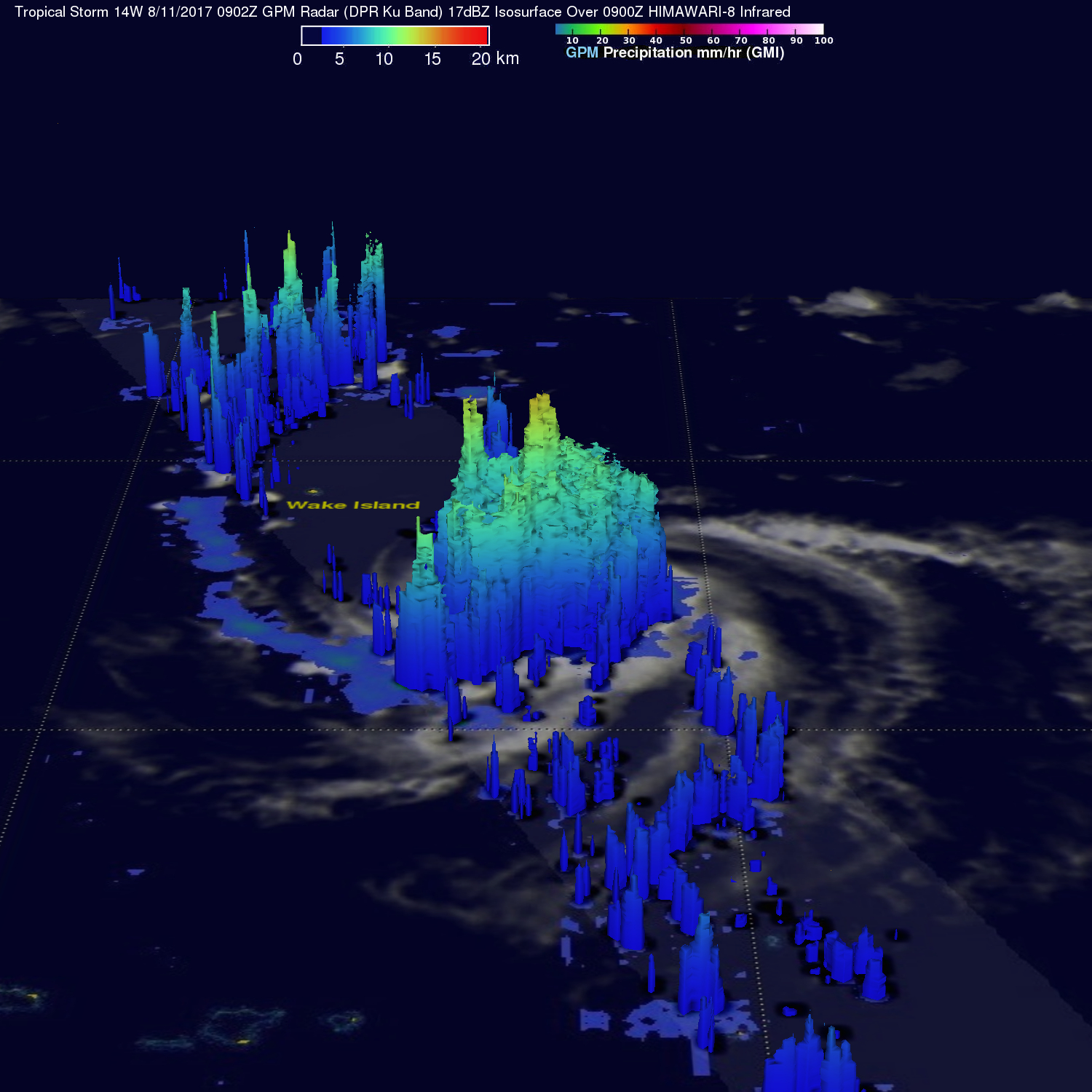
Data collected by GPM's Radar (DPR Ku Band) were used to show a 3-D view of the storm tops within tropical storm 14W. This "CAT scan" like cross-sectional image showed that towering thunderstorms at the center of the new tropical cyclone were reaching heights greater that 15.6 km (9.7 miles).
Environmental conditions are favorable for tropical storm 14W to develop further. The tropical storm is moving over warm ocean waters and will experience low vertical wind shear. The Joint Typhoon Warning Center (JTWC) predicts that tropical storm 14W will get a little stronger (45 kts) over the next three days as it tracks toward the northwest and then toward the northeast.