
Tropical Storm Colin's Heavy Rainfall Examined From Space
Earlier this week the Governor of Florida declared a state of emergency as tropical storm Colin moved over the state. In just a few days heavy rainfall from the tropical storm spread from Florida's Gulf Coast through Georgia to the North Carolina coastline. Street flooding was common in Florida. Severe flooding was not reported but over 250 mm (10 inches) of rain was reported in some areas. Two tornadoes and a water spout reported in Florida on Monday June 6, 2016 were an example of the unstable weather accompanying the tropical storm.
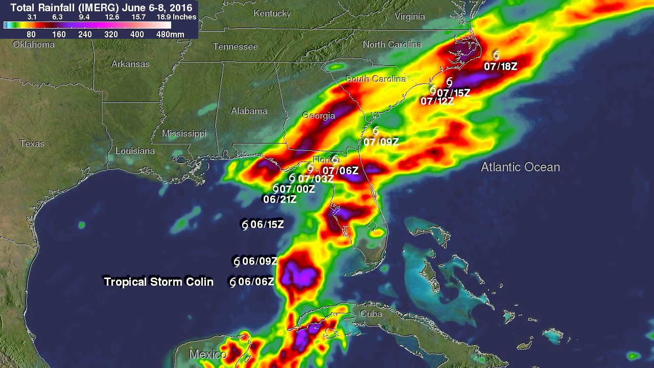
Data from NASA's Integrated Multi-satellitE Retrievals for GPM (IMERG) were used to estimate rainfall from tropical storm Colin. This analysis shows rainfall totals beginning with the time when Colin formed in the Gulf Of Mexico on June 6, 2016. The analysis ended on Wednesday June 8, after Colin transitioned to an extra-tropical cyclone and dissipated. Some rainfall on this analysis was caused by a frontal system moving through the area and pushing Colin out to sea. This IMERG analysis indicates that Colin's heaviest precipitation occurred over central Florida. Extreme rainfall amounts of over 280 mm (11 inches) were measured during this period where tropical Storm Colin formed in the Gulf Of Mexico. The approximate locations of tropical storm Colin are shown in white.