
Tropical Storm Ela To Pass Near Hawaiian Islands
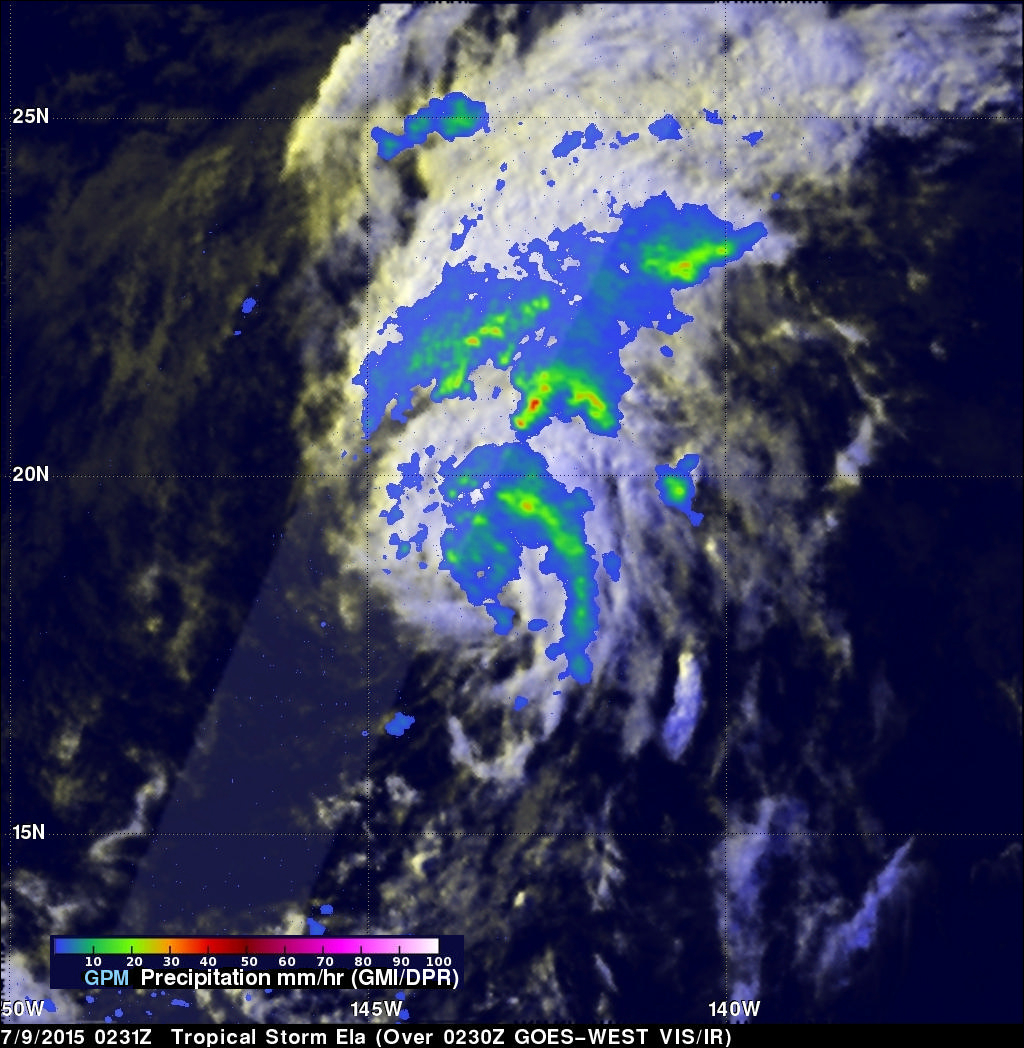
A tropical storm called Ela formed east-southeast of the Hawaiian Islands on July 8, 2015 and is expected to pass to the north of the island chain this weekend. GPM had a good view of Ela as the satellite flew over the forming tropical storm on July 8, 2015 at 1316 UTC (3:16 AM HST). The satellite passed above Ela again on July 9, 2015 at 0234 UTC (July 8, 2015 4:34 PM HST) showing that rainfall bands associated with the tropical cyclone were better organized. GPM's Microwave Imager (GMI) and Dual-Frequency Precipitation Radar (DPR) instruments found today that rainfall was falling at a rate of over 55 mm (about 2.2 inches) per hour in storms north of Ela's center of circulation.
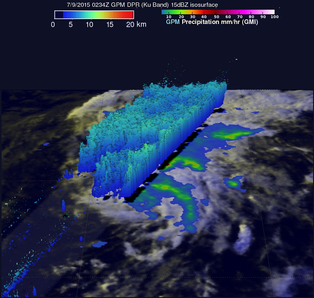
A 3-D view of tropical storm Ela using GPM's radar (DPR Ku band) shows that storm tops were not very high. A few thunderstorms were reaching heights above 10.4 km (6.4 miles) just north of Ela's center of circulation.
Ela is predicted to pass to the north of the islands over the weekend. Other than disrupting the normal trade winds and increasing shower activity, Ela is not expected to have a significant effect on the Hawaiian Islands .