
Tropical Storm Grace Viewed by GPM
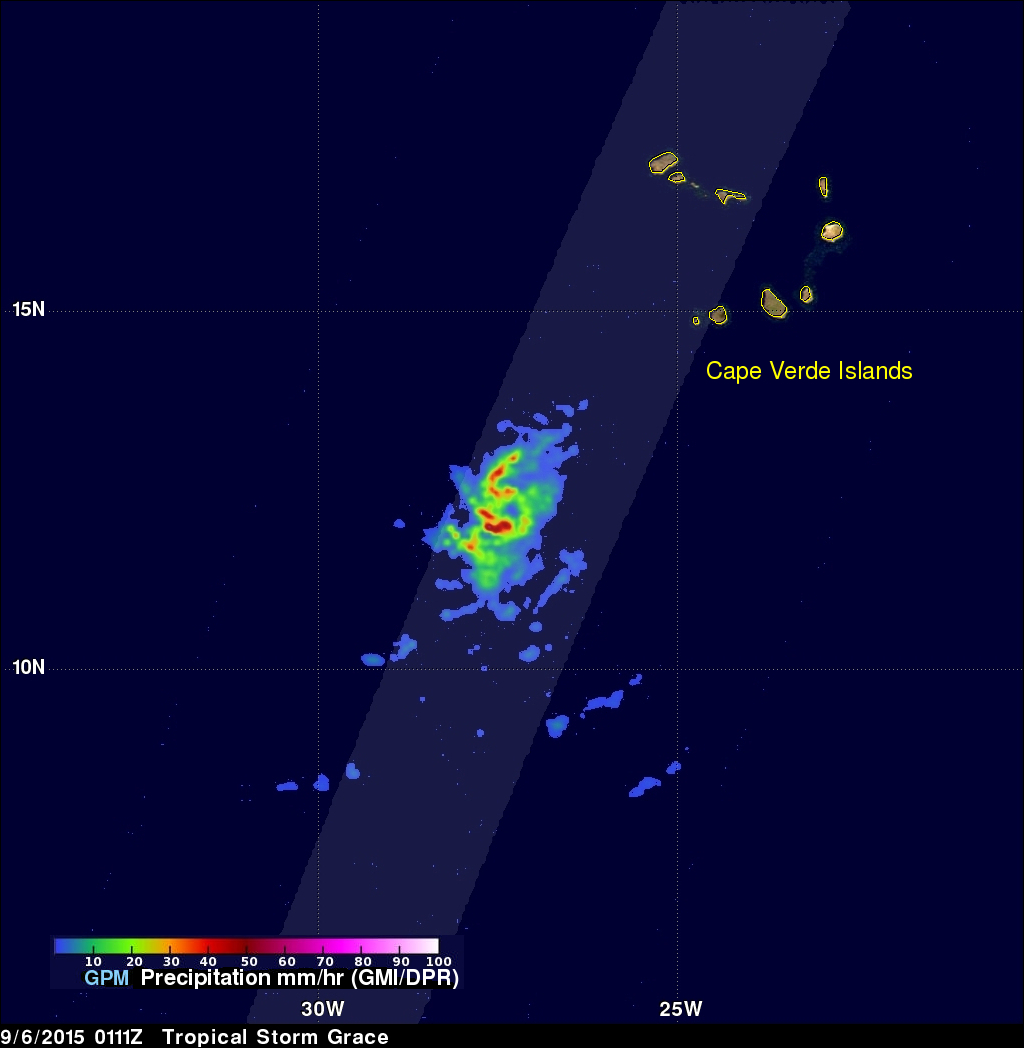
On Saturday September 5, 2015 a tropical disturbance south of the Cape Verde Islands in the eastern Atlantic Ocean was designated tropical depression number seven (TD7). TD7 was subsequently upgraded to tropical storm Grace that evening after the tropical depression showed increasingly better organization. The GPM core observatory satellite flew above tropical storm Grace on September 6, 2015 at 0111 UTC. Data captured by GPM's Microwave Imager (GMI) and Dual-Frequency Precipitation Radar (DPR) instruments with that pass showed that the tropical storm was small but had well defined curved bands of rainfall. GPM's DPR measured some rain in some bands falling at a rate of over 82 mm (3.2 inches) per hour.
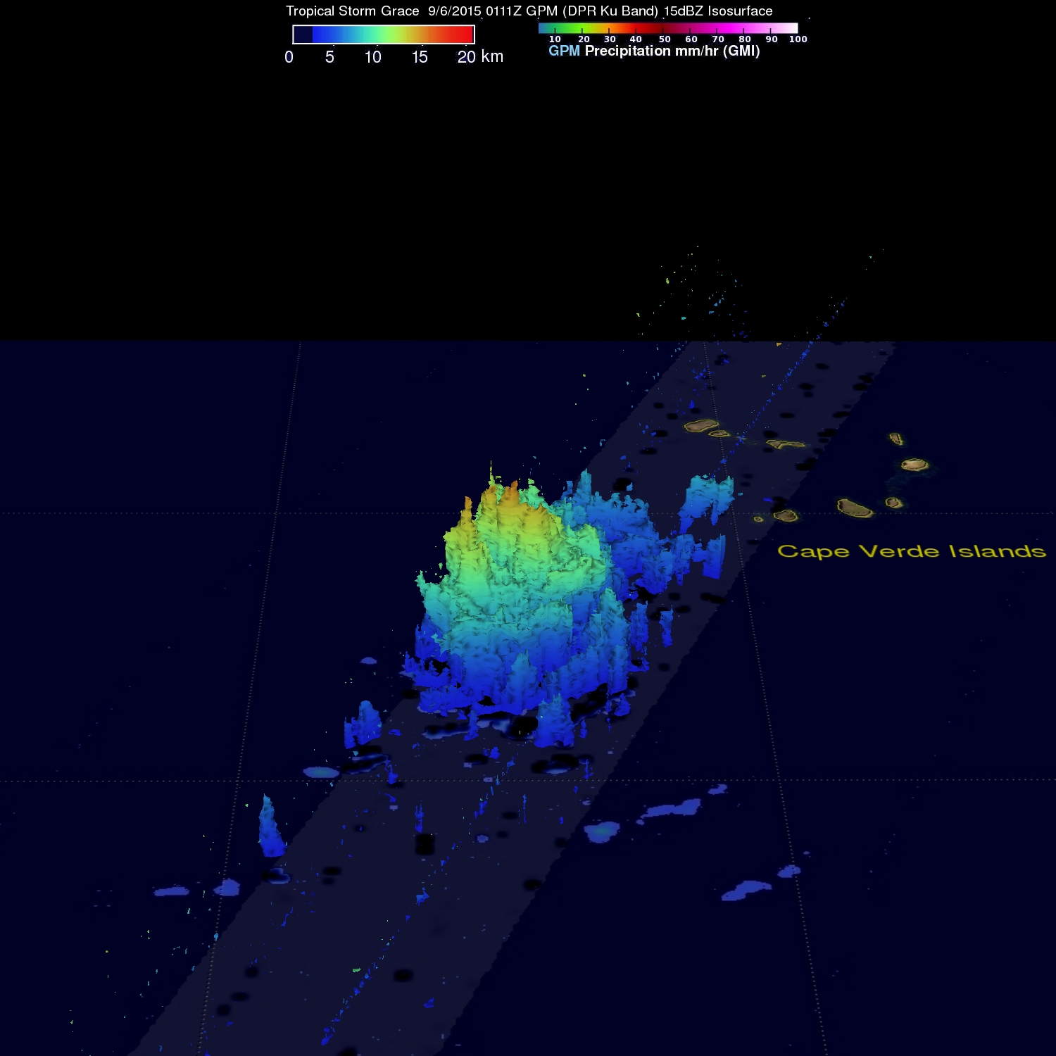
A 3-D image constructed from GPM's radar reflectivity data (DPR Ku band) shows that tropical storm Grace contained tall thunderstorms with tops reaching above 16km (9.2 miles). With the cooperation of other environmental factors such as warm ocean water and favorable vertical wind shear, these tall thunderstorms near the center of a tropical cyclone are often a sign of future intensification.