
Tropical Storm Javier Forms In The Eastern Pacific
Tropical storm Javier formed on August 7, 2016 in the Eastern Pacific Ocean off Mexico's western coast. Javier formed partially from the remnants of Hurricane Earl. Landslides caused by heavy rainfall from Hurricane Earl caused the reported deaths of at least 39 people in eastern Mexico.
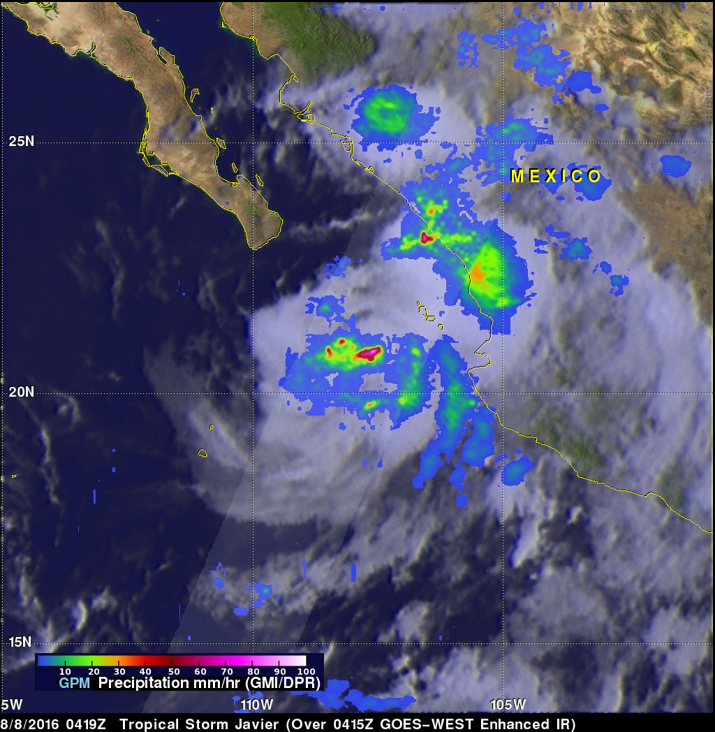
The GPM core observatory satellite flew above tropical storm Javier on August 8, 2016 at 0419 UTC. Rainfall was analyzed using GPM's Microwave Imager (GMI) and Dual-Frequency Precipitation Radar (DPR) instruments. Those data showed that Javier was producing heavy rainfall both near the center of the tropical storm and also near Mexico's coast northeast of Javier. Rain was measured by DPR falling at a rate of over 103 mm (4.1 inches) per hour near Javier's center of circulation. Precipitation was also calculated by GPM's GMI to be coming down at a rate of almost 60 mm (2.4 inches) per hour near near Mazatlan, Mexico.
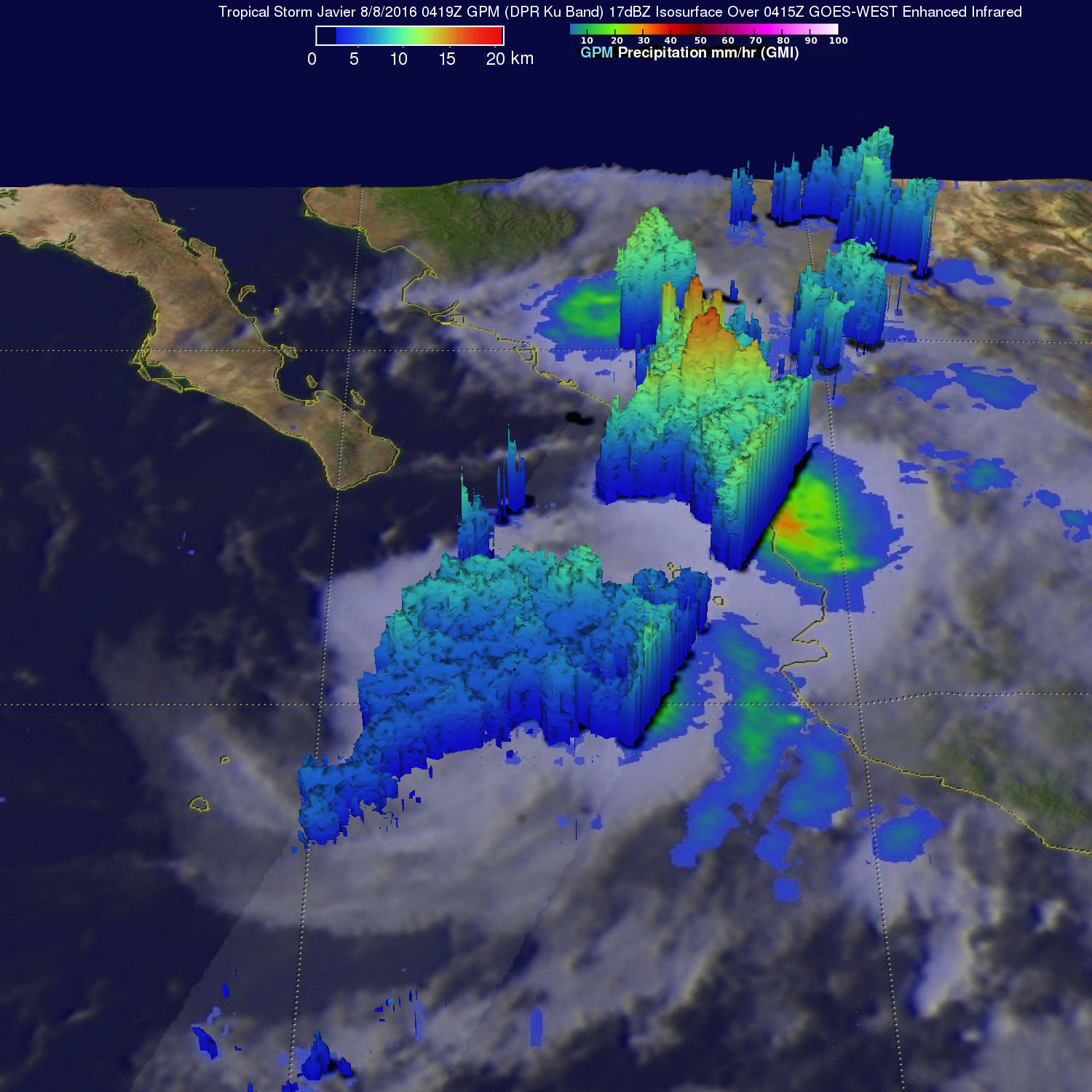
GPM's Radar (DPR Ku band) found that storm tops heights were highest in the storms near Mexico's coast. 3-D measurements of precipitation near Javiers's center showed storm tops were above 13 km (8.1 miles) while tall storms near Mexico's coast reached altitudes above 17 km (10.5 miles).
GPM is a joint mission between NASA and the Japanese space agency JAXA.