
Tropical Storm Kate Examined By GPM
Kate became the twelfth named tropical cyclone of the of the 2015 Atlantic hurricane season when it formed near the southeastern Bahamas on Sunday November 8, 2015. Kate re-curved toward the northeast and moved harmlessly over the open waters of the Atlantic. Kate's intensity peaked on November 11, 2015 with winds of about 65 kts making it a category one hurricane on the Saffir-Simpson Hurricane.
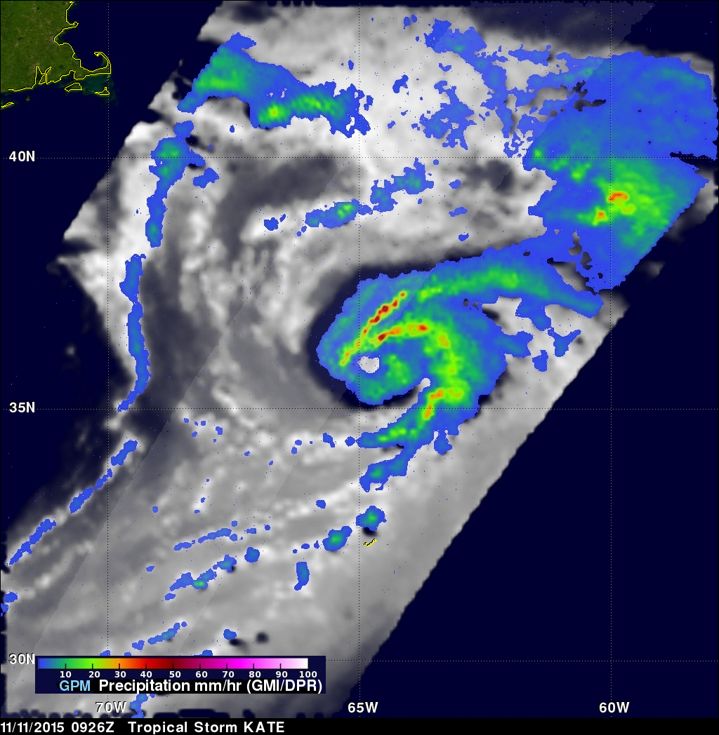
The GPM core observatory satellite flew above Kate on November 11, 2015 at 0926 UTC (4:26 AM EST) capturing data used in these images. Kate's maximum sustained winds were estimated at about 60 kts (69 mph) at that time making it a strong tropical storm. GPM's Dual-Frequency Precipitation Radar (DPR) sliced through Kate's western side and found that intense storms within feeder bands there were dropping rain at a rate of over 80 mm (3.1 inches) per hour.
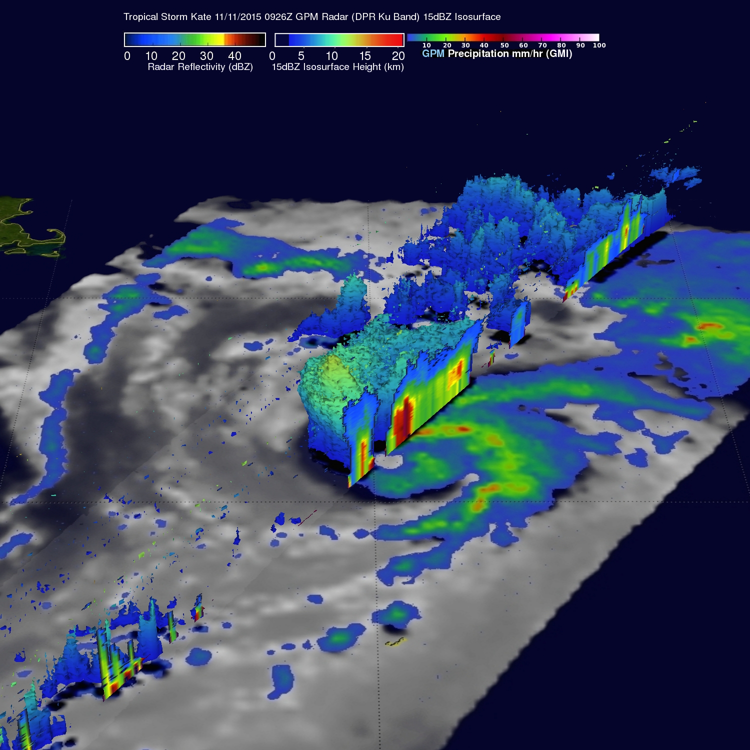
A 3-D cross section by GPM's Radar (DPR Ku Band) through Kate's weak eye shows intense storms swirling around the northern side of the tropical cyclone. Many of the of the storms in this area were returning radar reflectivity values of over 40dBZ.
Kate merged with a baroclinic zone over the north Atlantic and became an extra-tropical cyclone on November 12, 2015.