
Tropical Storm Matthew Forms Over the Windward Isles, Enters the Caribbean
A fairly strong tropical wave that had been making its way westward across the Central Atlantic over the past several days has now finally organized itself into a tropical storm, Tropical Storm Matthew, the 13th named storm of the season, while passing through the Windward Islands. The storm is poised to intensify as it enters the eastern Caribbean. The tropical wave leading to Matthew's formation emerged off of the coast of Africa back on the 23rd of September. However, despite having a robust level of convective thunderstorm activity, the wave did not acquire a closed low-level circulation until it reached the Windward Islands as the wave's convection was dispersed over a relatively broad area, impeding its ability to consolidate a center of circulation.
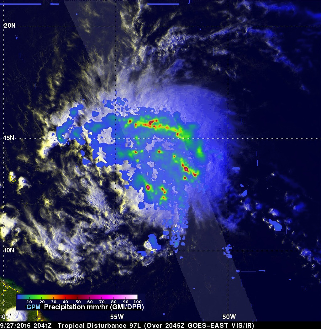
GPM captured this image of the wave late yesterday afternoon at 20:41 UTC (4:41 pm EDT) as it was approaching the Windward Isles. The image shows rain rates derived from GPM's GMI microwave imager (outer swath) and dual-frequency precipitation radar or DPR (inner swath) overlaid on enhanced VIS/IR data from the GOES-East satellite. The rain distribution at this time shows that the wave contains a broad area of light rain (blue areas) with several embedded bands of moderate rain (green areas) containing relatively scattered areas of heavier rain (dark red areas). These bands are distributed throughout the system and show only slight evidence of curvature, which indicates that a well-defined cyclonic circulation is still lacking.
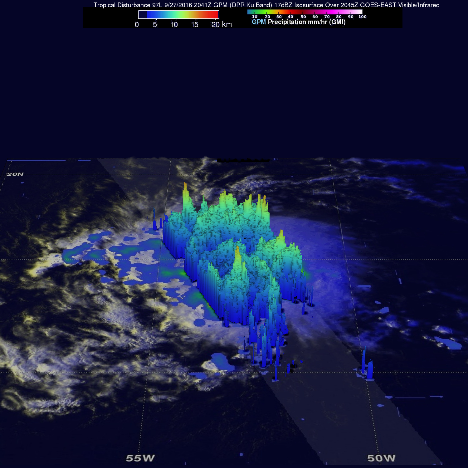
The next image was taken at the same time and shows a 3D view of the wave from the DPR. Consistent with the previous image, convective towers, some reaching as high as 15 km (shown in orange tops) and though loosely organized into bands, are scattered throughout the wave. These towers are coincident with the areas of heavy rain in the previous image and indicate areas of active deep convection that are releasing heat into the system. However, because they are not concentrated together, the wave was slow to organize into a tropical storm.
Over the next few days, the National Hurricane Center is forecasting Matthew to intensify into a hurricane, the 5th of the season, and to continue its westward track into the central Caribbean. After which, the storm is expected to take a more northerly track in the direction of Jamaica.