Tropical Storm Otto Develops, Threatens Central America
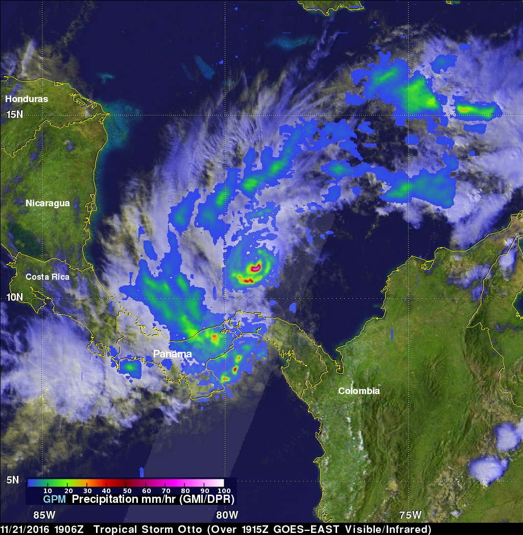
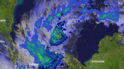
Tropical storm Otto formed in the southwestern Caribbean north of Panama on November 21, 2016. The GPM core observatory satellite had an excellent daytime view of the newly formed tropical storm on November 21, 2016 at 1906 UTC (2:06 PM EST). Otto had wind speeds estimated at 45 kts (52 mph) at that time. GPM satellite rainfall data are shown overlaid on a visible and infrared image captured by the GOES-EAST satellite at 1915 UTC (2:15 PM EST). GPM's Microwave Imager (GMI) and Dual-Frequency Precipitation Radar (DPR) revealed that the newly formed tropical storm had deep convective bursts in powerful storms near the center of circulation. Rain was measured by DPR falling at a rate of over 94 mm (3.7 inches) per hour.
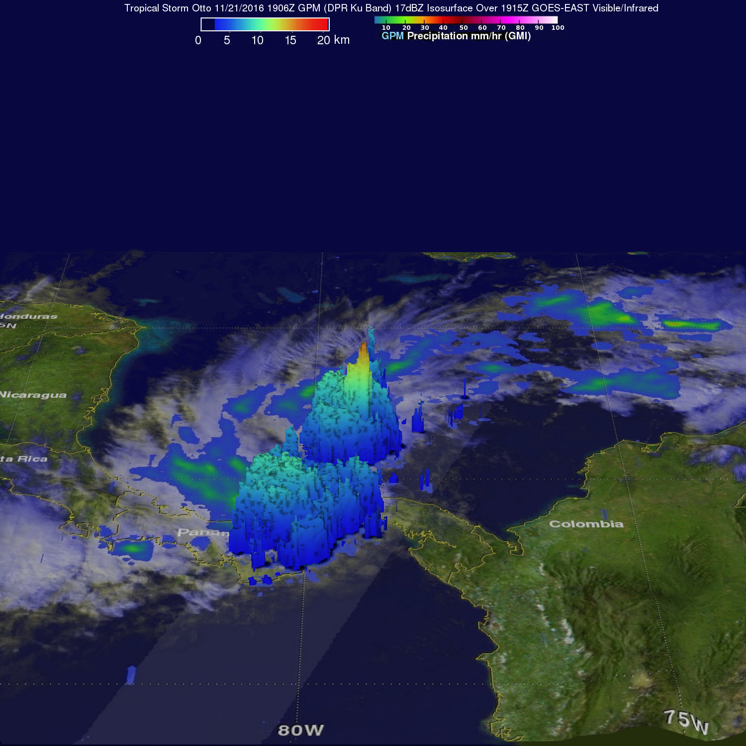
3-D measurements of tropical storm Otto's precipitation were made with GPM's radar (DPR Ku Band). DPR measured tall convective storms near Otto's center. Some of these tall storms were found by GPM to stretch to heights above 17 km (10.5 miles).
The National Hurricane Center (NHC) predicts that tropical storm Otto will gradually intensify and may become a hurricane within 36 hours. Steering currents above Otto are presently light so the tropical storm is predicted to move very slowly. Otto is expected to be a hurricane when it hits the central American coast near the Nicaragua and Costa Rica border in about three days. Otto is expected to weaken over land but could then cross into the Eastern Pacific as a tropical depression.