
Tropical Storm Rick Examined By GPM
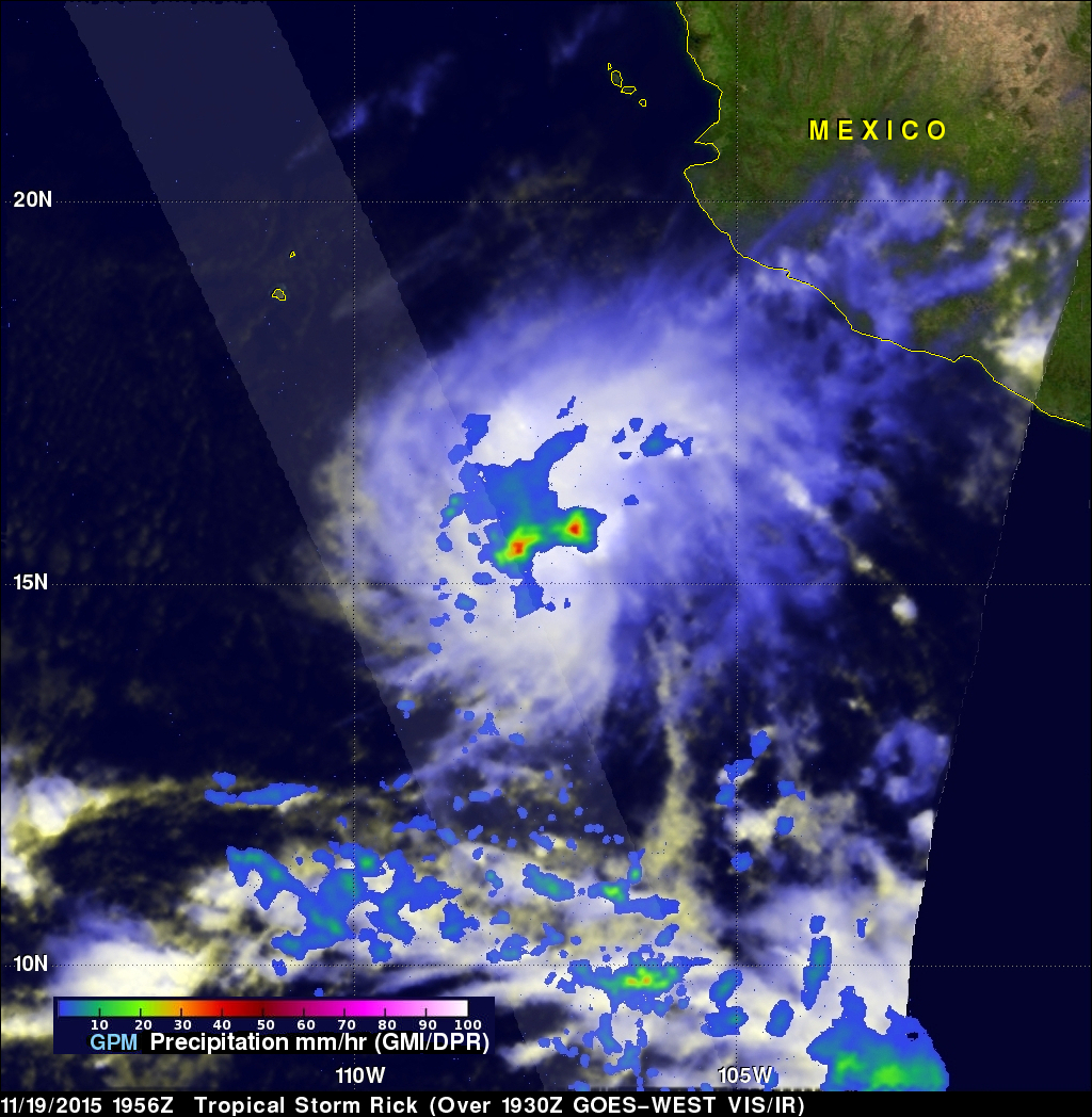
Tropical storm Rick is the latest tropical cyclone to form in the 2015 Eastern Pacific Ocean hurricane season which has spawned a record number of dangerous hurricanes. Tropical storm Rick was moving over the eastern Pacific Ocean well off the Mexican coast when the GPM core Observatory satellite flew over on November 19, 2015 at 1956 UTC. Data captured by GPM's Microwave Imager (GMI) and Dual-Frequency Precipitation Radar (DPR) show that tropical storm Rick had a couple areas near the center of circulation that were dropping rain at a rate of over 41.6 mm (1.6 inches) per hour.
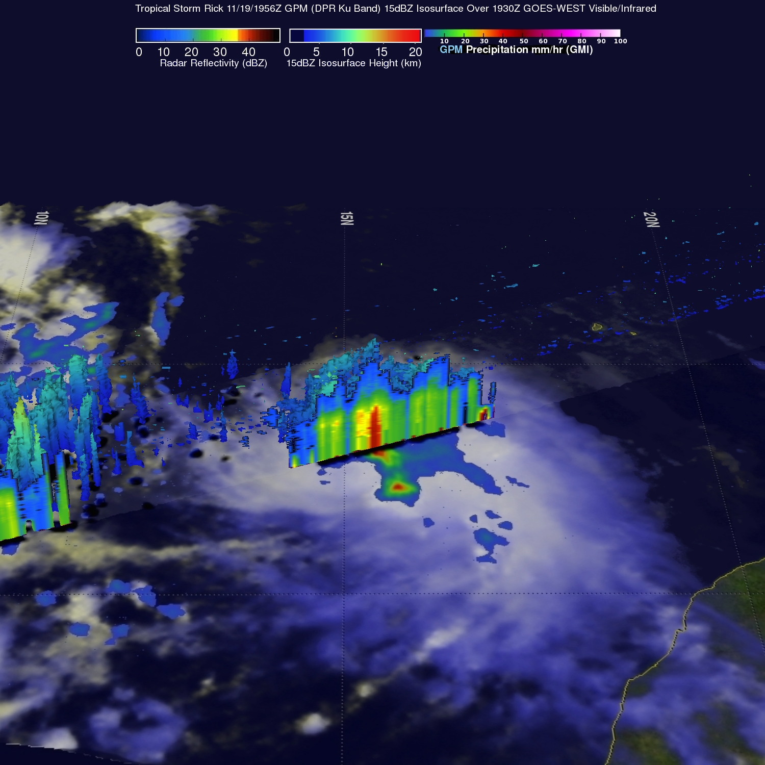
GPM's radar (Ku Band) sliced through Rick's western side and provided a 3-D view of the precipitation in that area. GPM revealed that storm top heights were about 11 km (6.8 miles) and showers within convective storms were returning radar reflectivity values of over 40 dBZ to the satellite.
At the time of this look by GPM Rick was in a relatively hospitable environment with warm waters and low vertical wind shear but the tropical storm is predicted to strengthen little over the next few days. Rick is then expected to move over cooler waters and experience increased vertical wind shear that will extinguish the tropical cyclone.