Typhoon Soudelor Threatens Taiwan And China
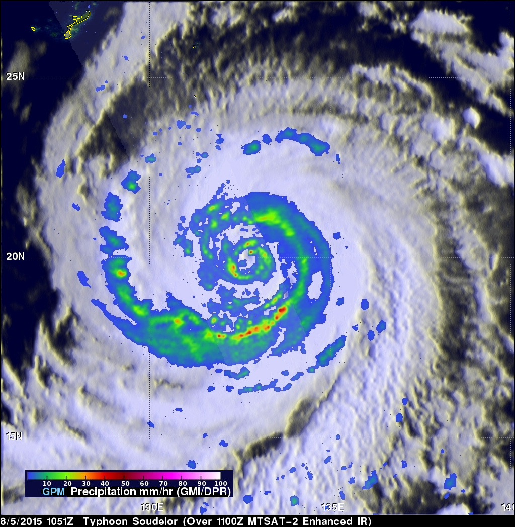
Typhoon Soudelor's sustained winds were about 105 kts ( about 121 mph) when the GPM core observatory satellite flew above on August 5, 2015 at 1051 UTC. A rainfall analysis was made from data collected from GPM's Microwave Imager (GMI) and Dual-Frequency Precipitation Radar (DPR) instruments. This analysis showed that Soudelor was very large and had a well defined eye. Intense feeder bands are shown spiraling into the center.
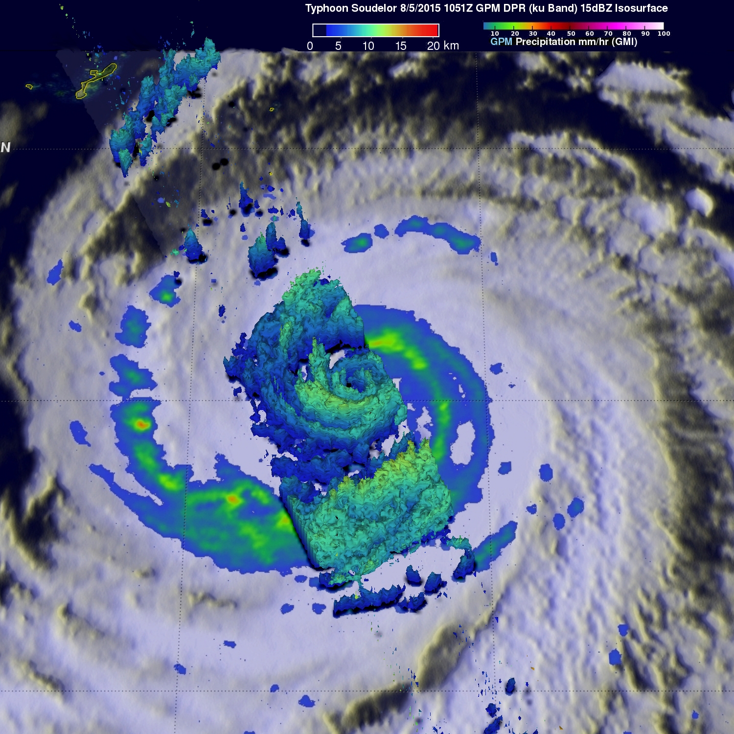
Three dimensional radar reflectivity data GPM's DPR (ku Band) were used to construct a simulated cross section through typhoon Soudelor's center. This view from the south shows the 3-D vertical structure of rainfall within Soudelor. Some storms examined with GPM's radar reached heights of over 12.9 km (about 8 miles) and were dropping rain at a rate of over 87 mm (3.4 inches).
The Joint Typhoon Warning Center (JTWC) predicts that typhoon Soudelor will continue to be a powerful typhoon and winds are predicted to increase to 120 kts (138 mph) before impacting Taiwan in a couple days. Taiwan's rugged terrain is expected to take it's toll on Soudelor but the typhoon is still predicted to have wind speeds of 90 kts (103.5 mph) while approaching China.