Weaker Typhoon Nangka Threatens Japan

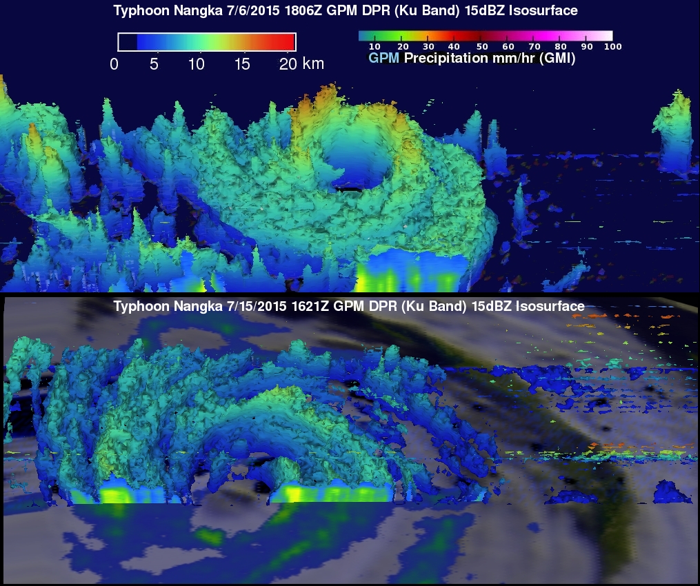
Typhoon Nangka was a super typhoon with winds of 135 kts (155 mph) over the open waters of the Pacific Ocean last week. Nangka is predicted by the Joint Typhoon Warning Center (JTWC) to have weakened to barely typhoon intensity with winds of less than 65 kts ( 75 mph) before hitting Japan on July 16, 2015. The GPM core observatory satellite passed above early in the life of the typhoon on July 6, 2015 when Nangka was east-southeast of Guam. At that time Nangka had formed a nearly perfectly circular eye that contained powerful storms reaching to altitudes of close to 17km (10.5 miles). GPM flew over typhoon Nangka on July 15, 2015 at 1621 UTC as the weakening typhoon approached the Japanese island of Shikoku. GPM's Dual-Frequency Precipitation Radar (DPR) instrument (DPR) revealed that the highest thunderstorm tops in Nangka's western eye wall were then reaching heights of about 12km (7.4 miles).

