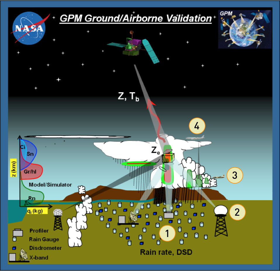
This diagram illustrates the GPM Ground Validation technique of using overlapping field measurements to validate rain's physical properties.
- Ground level suites of high density disdrometer and rain gauge instruments to characterize precipitation properties and variability
- Multi-frequency/polarimetric radar and profiler observations of cloud microphysical properties and rainfall from the surface through the atmospheric column
- Direct in-situ and profiling aircraft measurements providing detailed particle microphysical information (sizes, shapes, types, numbers etc.) and evolution in the column as rain falls to the ground that can then be compared with radar observationsH
- High-altitude airborne (NASA ER-2, DC-8) dual-frequency radar and multi-frequency radiometers that mimic measurements made by the GPM Core and constellation satellites.
Learn more about Physical Validation.
Credits
NASA

