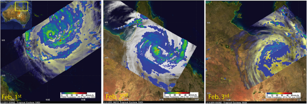
TRMM Satellite image of Tropical Cyclone Yasi on February 1st to 3rd, 2011 (left to right) as it made landfall over Queensland, Australia.
TRMM’s TMI and PR instruments observed Cyclone Yasi as it developed from a Category 3 tropical cyclone (Feb. 1st, left), to a Category 5 event (Feb. 2nd) when it made landfall with wind gusts reported at up to 186 mph, and then finally as it began to dissipate on Feb. 3rd (right).
Credits
Hal Pierce
Keywords

