
TRMM Examines Another Potential Tropical Cyclone
The Tropical Rainfall Measuring Mission (TRMM) satellite was placed into its low-earth orbit in November of 1997. Its primary mission has been to measure rainfall from space. TRMM has provided space borne rain radar and microwave radiometric data that measure the vertical and horizontal distribution of rainfall over the tropics. It has also been valuable for monitoring the development of tropical cyclones, especially over remote parts of the open ocean.
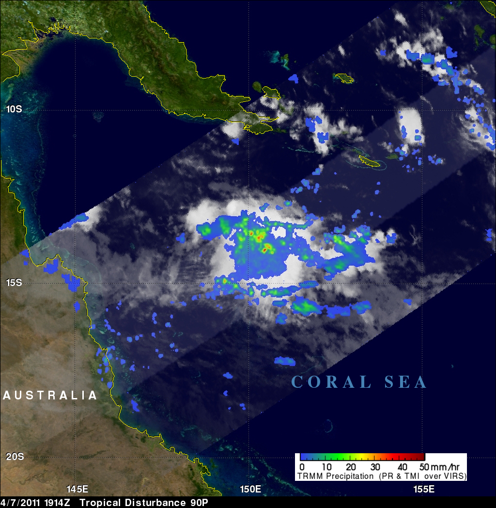
The image on the right uses data captured by the TRMM satellite on 7 April 2011 at 1914 UTC. It shows a TRMM satellite view of rain intensity in an area of disturbed weather over the open waters of the Coral Sea northeast of Australia. Rain rates in the lighter swath are from the TRMM Precipitation Radar (PR), while those in the outer portion are from the TRMM Microwave Imager (TMI). The rain rates are overlaid on infrared (IR) data from the TRMM Visible Infrared Scanner (VIRS).
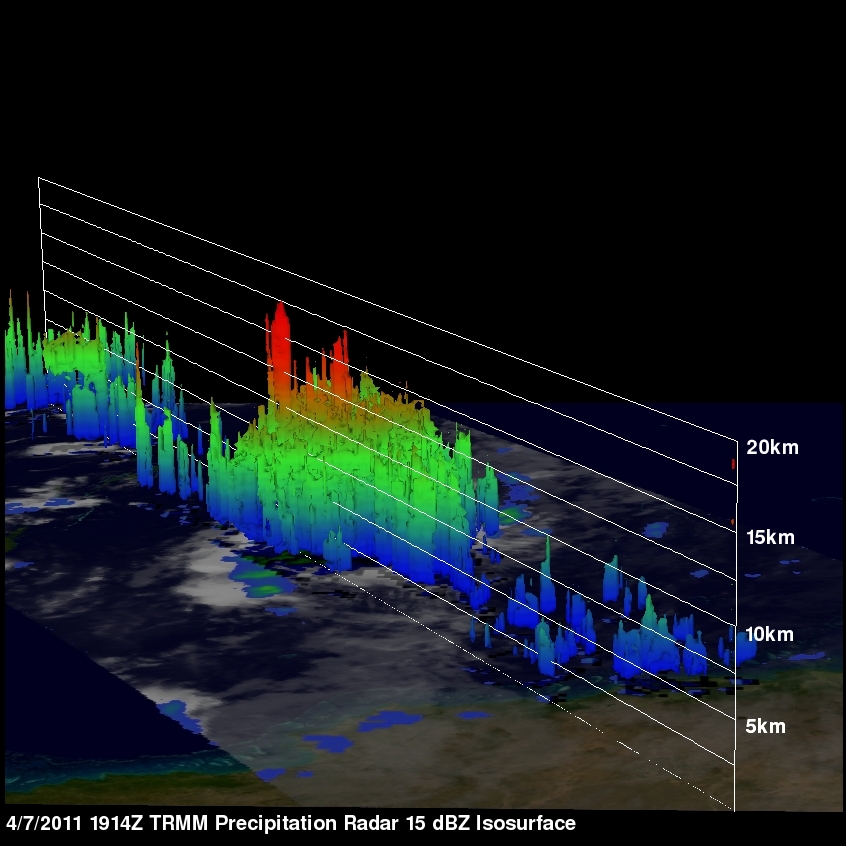
The image on the right shows a 3D view of a potential tropical cyclone. TRMM PR data were used to measure vertical precipitation structures within these storms. TRMM PR data reveals that violent thunderstorms near the center of this area of disturbed weather reached to heights above 17km (~10.6 miles).