Tropical Cyclone Errol Near Australia
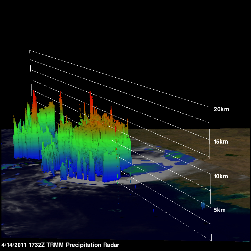
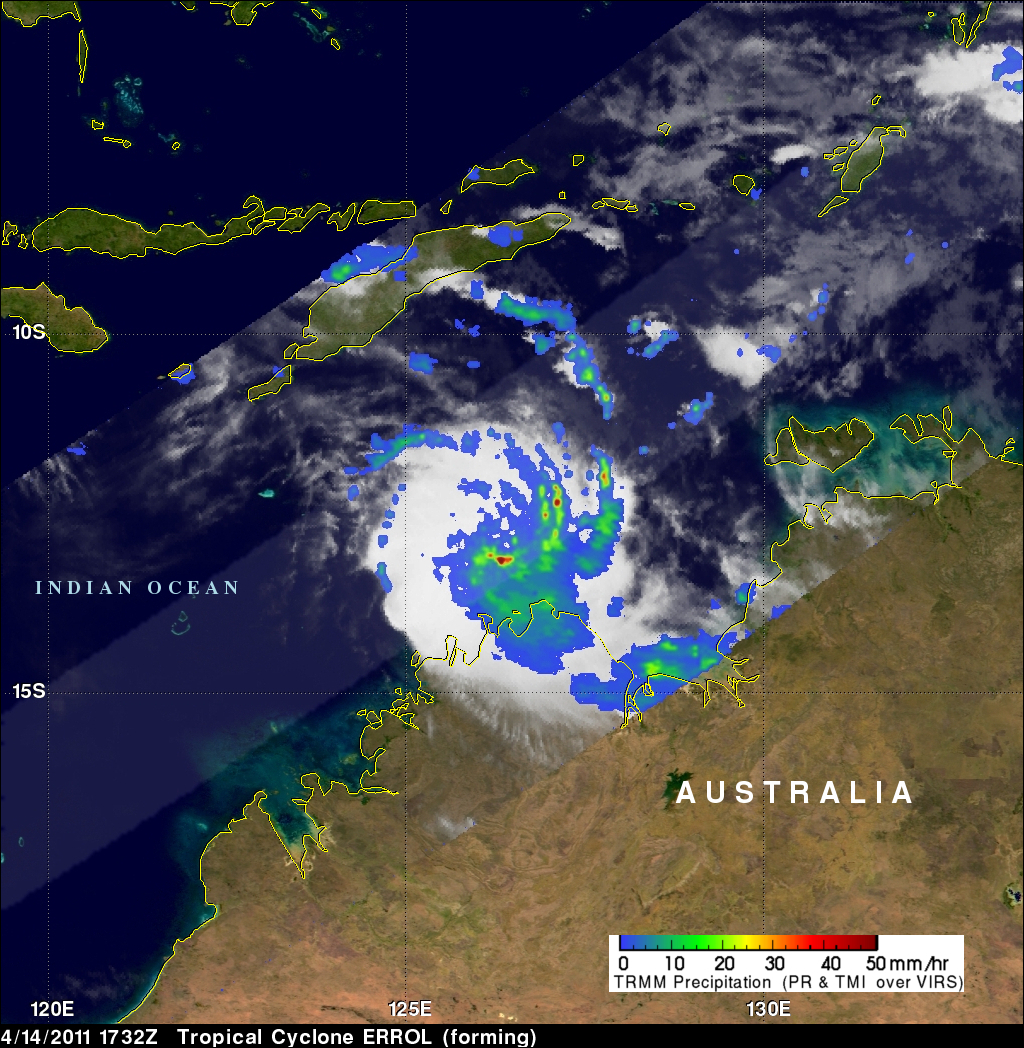
The South Indian Ocean tropical cyclone season is nearing it's end but another tropical cyclone called ERROL has developed northwest of Australia. The TRMM satellite flew over ERROL when it was getting organized on 14 April 2011 at 1732 UTC. The image on the left above shows an analysis of rainfall using data from TRMM's Microwave Imager (TMI) and Precipitation Radar (PR) instruments. The light swath shows the locations of some heavy thunderstorms as TRMM's PR crossed over ERROL's center of circulation. The image on the upper right shows a 3-D image of these thunderstorms made from those radar data collected at that time.

ERROL is expected to move westward away from Australia over the open waters of the Indian Ocean with wind speeds increasing to a maximum of 55 knots (~63 mph).


