Snow on the Ground, Satellites Overhead
Chris Kidd is a hydrologist at Goddard Space Flight Center. This week he is at the CARE site in Ontario and writes to us about this week's flights.
Although the excitement of the lake-effect snow last weekend was welcome, in contrast this week was somewhat benign. There were a number of good opportunities identified in the model forecasts that didn’t really materialize, leaving us with a number of, although marginal, still useful events.
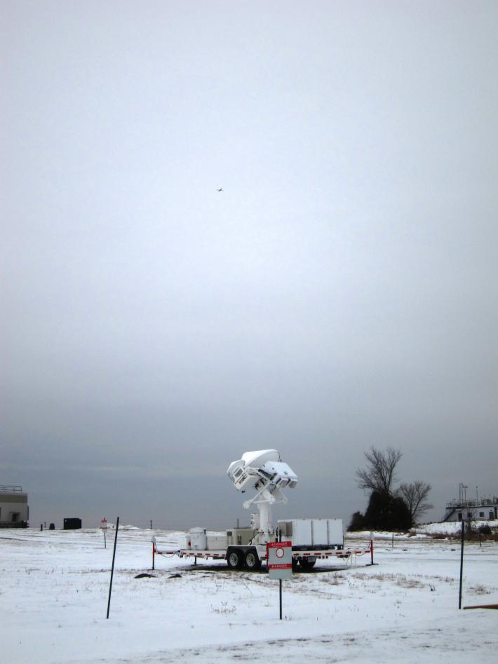
 The dual-frequency radar at the CARE site Friday, February 17th. The little spec in the sky is the Citation aircraft flying overhead.
Credit: NASA / Chris Kidd.
On Tuesday little snow was forecast, although with a very moist atmosphere we decided to go ahead and plan for ground operations and over-flights by the Citation to collect cloud data, coincident with a number of satellite overpasses. In fact, this proved to be a very good day; the moisture was enough to produce widespread light snow – the type of snowfall conditions that exist most of the time here and the type that satellites have the most difficulty identifying and measuring.
The forecast for Thursday was more optimistic with a good snowfall or mixed snow/rain event, although there was a good degree of disagreement in the models as to when the precipitation would start. Plans were made for an early start to ensure that we caught the initial precipitation, particularly with any transition between the snow and the rain.
Heading out to the CARE site it was clear that the snow had started early and by that stage it was a mixture of freezing rain and snow flurries. By the time the DC-8 aircraft was in the air much of the precipitation had passed over us, and what remained had transitioned to rain. Despite this the DC-8 collected some very nice data over Lake Ontario to the south, together with the Canadian Convair research aircraft.

