
Andrea brings Heavy Rains to Cuba and parts of the US East Coast
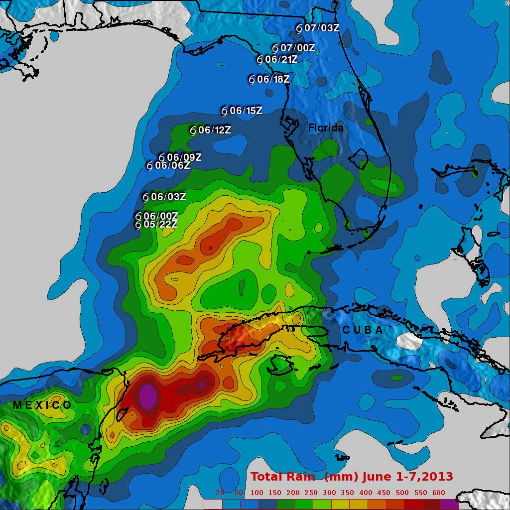
This first image shows TMPA rainfall totals for the eastern Gulf and the surrounding region for the period 1-7 June 2013, covering the time before Andrea formed until it was passing through eastern North Carolina. TRMM shows rainfall totals on the order of 400 to 500 mm (~16 to 20 inches, shown in orange and red, respectively) stretching from the eastern tip of the Yucatan to western Cuba and over the southeast Gulf. Upwards of 600 mm (~24 inches, shown in purple) occur offshore over the Yucatan Straight. There were reports of widespread flooding over western Cuba but no injuries. Elsewhere, amounts over South Florida are on the order of 100 to 200 mm (~4 to 8 inches, shown in darker blue and green, respectively), while amounts over northern Florida are generally on the order of 100 mm (~4 inches) or less (shown by the lighter blues).
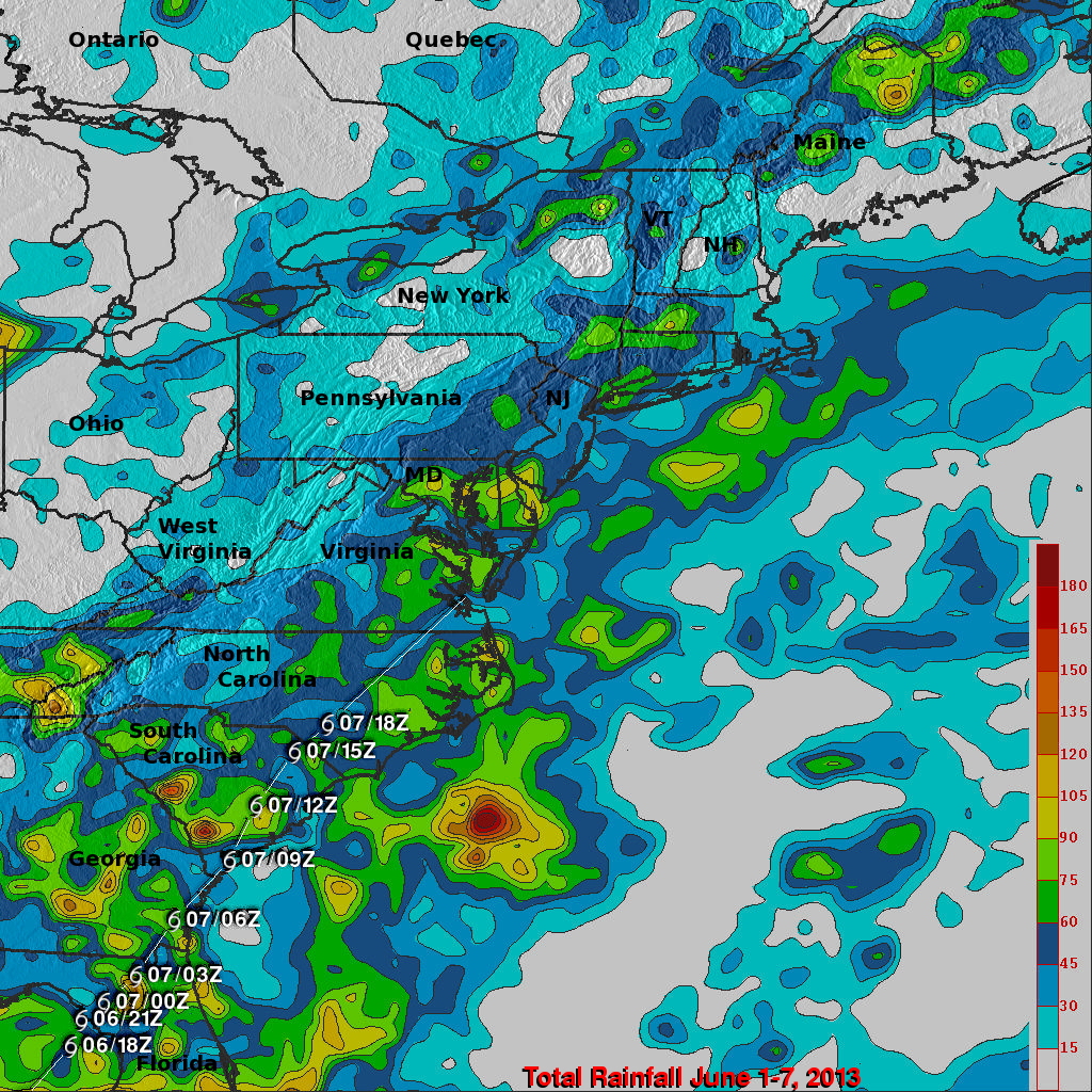
As Andrea moved northward up the East Coast, it began to accelerate as it transitioned into an extratropical system. Because of this, rainfall amounts were significantly lighter. This second image shows TMPA rainfall totals for the eastern US for the same period. In general rainfall amounts along Andrea's track (shown by the white line connecting the storm symbols) were between 45 and 90 mm (~2 to 4 inches, shown in darker blue and green, respectively; note the change in color scale) with locally high amounts from around 100 mm (~4 inches, shown in yellow) to around 150 mm (~6 inches, shown in red) over parts of South Carolina, eastern Georgia, and coastal North Carolina.