Another Possible Tropical Cyclone Approaches Oman
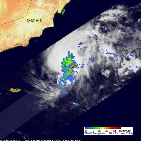
On November 2011 at 1541 UTC the TRMM satellite passed over another stormy area heading toward Oman from the Arabian sea . Another tropical cyclone may be forming in this area less than a week after deadly tropical storm Keila hit Oman. A rainfall analysis from TRMM's Microwave Imager (TMI) and Precipitation Radar (PR) is shown in the image above. Rainfall derived from PR data, shown in a lighter shade, reveals that an area of extremely heavy rainfall was located in the center of this stormy area.
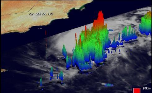
TRMM's PR data were again used to show the 3-D structure of this stormy area. Some of these very powerful storms were towering to heights of about 17km (~10.6 miles). Radar Reflectivity values of over 55 dBZ within these storms is additional evidence of very heavy rainfall.


