Arlene Is First 2011 Atlantic Tropical Storm
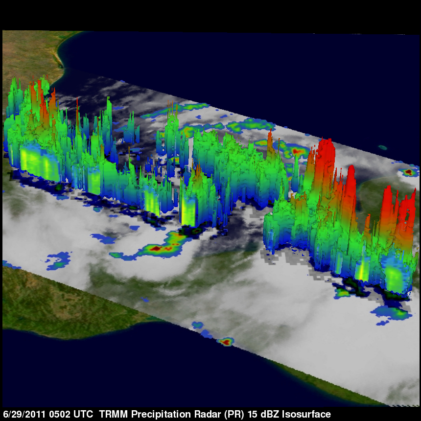
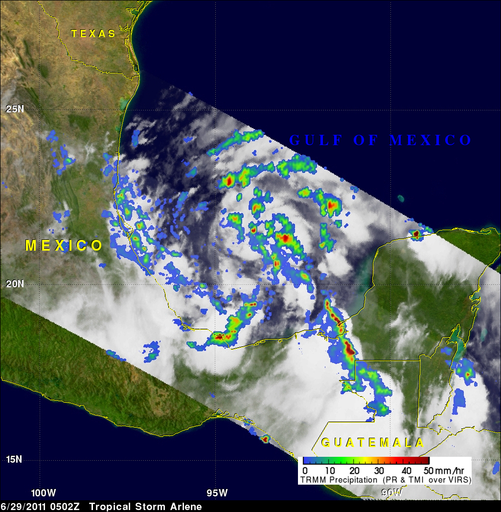
The National Hurricane Center (NHC) named Tropical Storm Arlene the first tropical storm of the 2011 Atlantic hurricane season on 29 June 2011 at 0000 UTC (7 PM CDT). The TRMM satellite had a good look at Arlene when it passed above on 29 June 2011 at 0502 UTC (0:02 AM CDT). At that time Arlene's winds were estimated to be about 34 knots (~39 mph) indicating that it was barely a tropical storm. TRMM's Microwave Imager (TMI) and Precipitation Radar (PR) data were used in the analysis on the upper left and show that Arlene was getting better organized and contained scattered heavy thunderstorms dropping rain at a rate of over 50 mm/hr (~2 inches). Some of the heaviest rainfall was not near the center of Arlene's circulation but in feeder bands over land along the southwestern Gulf Of Mexico. A 3-D analysis of Arlene's vertical structure using TRMM PR revealed that very powerful thunderstorms in a feeder band over the southeastern Yucatan Peninsula reached to heights of 17 km (~10.6 miles).