
Arthur Becomes First Atlantic Tropical Storm
A tropical disturbance east of Florida's coast became better organized and was upgraded to a tropical depression by the National Hurricane Center (NHC) on June 30, 2014 at 11:00 PM EDT (July 1, 2014 at 0300 UTC). On July 1, 2014 at 1100 AM EDT (15:00 UTC) the NHC upgraded tropical depression one to tropical storm Arthur.
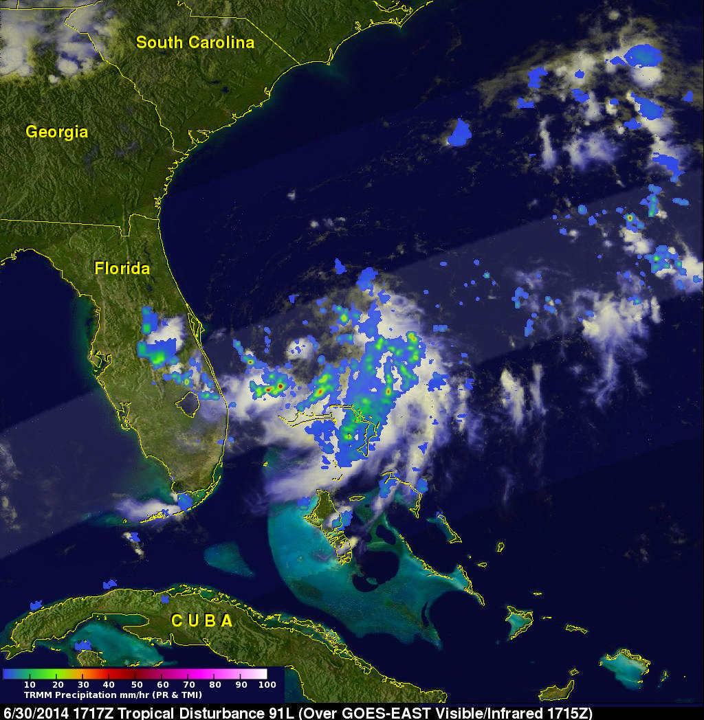
The TRMM satellite had an excellent view of the forming tropical depression (TD01) on June 30, 2014 at 1717 UTC (1:17 PM EDT). Intense thunderstorms were shown by TRMM to be wrapping around the southern side of the low pressure center. TRMM's Precipitation Radar (PR) revealed that rainfall intensity had increased to over 84.2 mm (about 3.3 inches) per hour in a group of convective thunderstorms north of Grand Bahama Island.
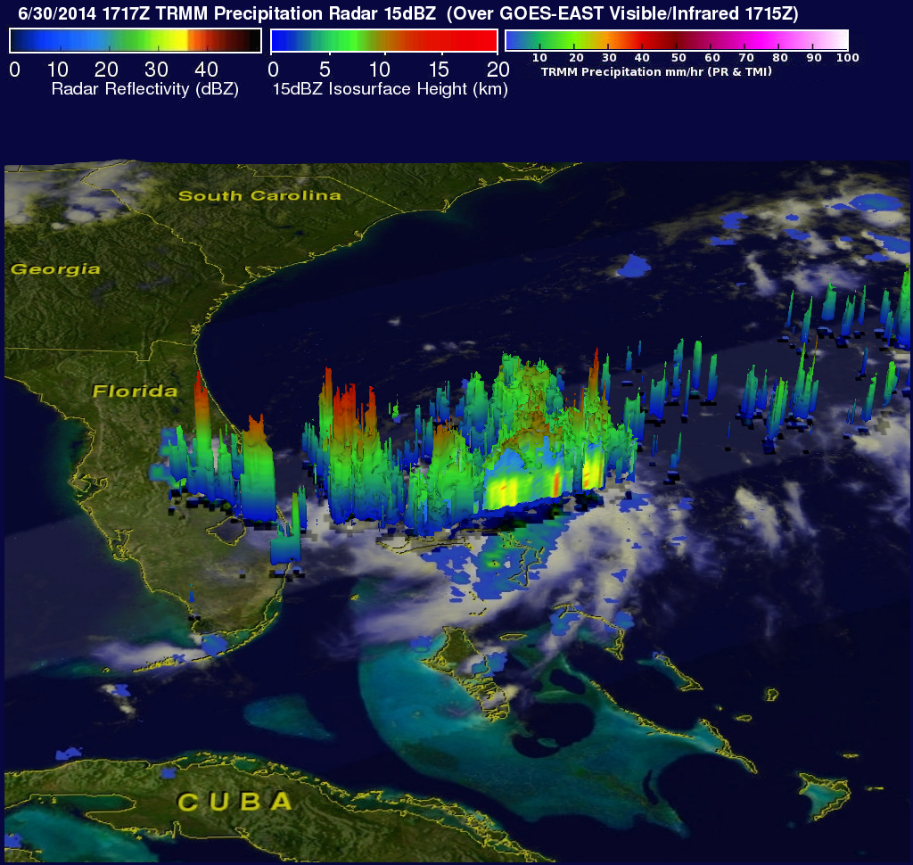
TRMM PR data were used to show the vertical structure of the developing tropical depression. This simulated 3-D view was constructed from radar reflectivity values received by the satellite. Thunderstorms over eastern Florida and in the Atlantic Ocean southeast of the center of circulation were found by TRMM PR to reach heights of over 15.5 km (about 9.6 miles).
Tropical storm Arthur has recently been moving very slowly with environmental conditions becoming favorable for Arthur to become a hurricane as it travels toward the North Carolina coast over the next few days.
Images and Captions by Hal Pierce (SSAI/NASA GSFC)