
Atlantic Tropical Storm Bertha Forms
The National Hurricane Center (NHC) upgraded a well defined low pressure center east-southeast of Barbados to tropical storm Bertha on July 31, 2014 at 0300 UTC (11 PM AST). Bertha's development is inhibited by vertical wind shear that may weaken as the tropical storm moves over the northeastern Caribbean Sea.
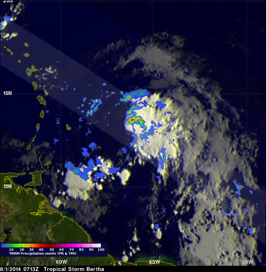
The TRMM satellite had an excellent view of tropical storm Bertha on August 1, 2014 at 0713 UTC (3:13 AM AST). Rainfall from TRMM's Microwave Imager (TMI) and Precipitation Radar (PR) with this TRMM pass is shown overlaid on a GOES-EAST enhanced infrared image received at 0715 UTC. Those data reveal that rain was falling at a rate of over 109 mm (about 4.3 inches) per hour northeast of the sheared storm's center.
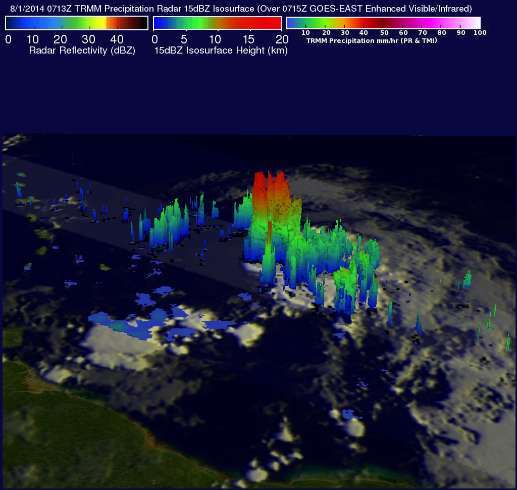
Radar reflectivity data from TRMM's Precipitation Radar (PR) instrument were used in this 3-D view to show the structure of precipitation within tropical storm Bertha. This view (from the south) shows that intense thunderstorms were reaching heights of over 15km (about 9.3 miles). Radar reflectivity values greater than 56dBZ were returned to the satellite from heavy rainfall in these storms. The latent heat released within tall thunderstorm towers in the center of tropical cyclones can be an indicator of future intensification but strong vertical wind shear is expected to be a limiting factor for Bertha.