Boris Dissipates, Atlantic Disturbance Stengthens
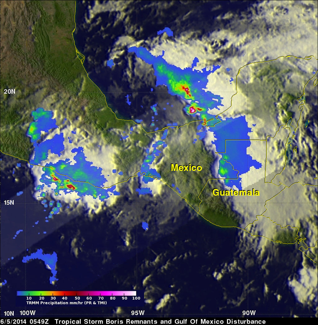
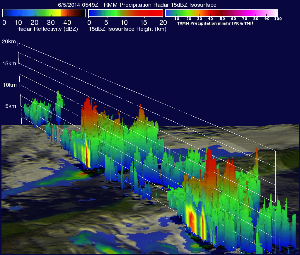
On June 5, 2014 at 0549 UTC (1:49 AM EDT) the TRMM satellite flew above the remnants of tropical Depression Boris and powerful thunderstorms that recently developed in the Gulf of Mexico. Rainfall derived from TRMM Microwave Imager (TMI) and Precipitation Radar (PR) data are shown overlaid on an enhanced infrared image from the GOES-EAST satellite. TRMM found heavy rainfall over Mexico's Pacific coast and with a disturbance in the Gulf Of Mexico (90L). Rainfall was falling at the extreme rate of over 163 mm (about 6.4 inches) per hour in powerful thunderstorms associated with the low pressure center in the Bay of Campeche. A 3-D view using TRMM PR data found that thunderstorm tops were reaching altitudes above 16.5 km( about 10.2 mile) along the western coast of Mexico and above 15.5 km (about 9.6 miles) in the Bay Of Campeche. The National Hurricane Center (NHC) gives the disturbed weather in the Bay Of Campeche a 30% chance of becoming the first tropical cyclone in the 2012 Atlantic hurricane season.